
Tag "Topographic data"
GIS
GIS Data
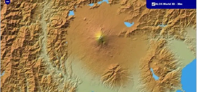
30 meter World Elevation Data is Now Available at JAXA’s Site Free of Charge!
The Japan Aerospace Exploration Agency (JAXA) will begin publishing free of charge an elevation data set that can express undulations of terrain over the world with a resolution of 30
GIS
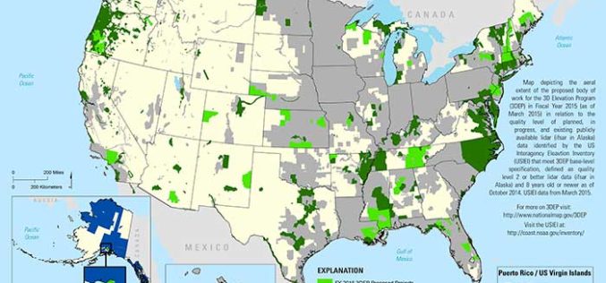
State and Regional 3DEP Stakeholder Workshops Underway
The U.S. Geological Survey National Geospatial Program is developing the 3D Elevation Program (3DEP) to respond to growing needs for high-quality topographic data and for a wide range of other
