Trimble Webinar: How Collecting High Quality GIS Field Data Can Improve Your Bottom Line
As a GIS professional, gathering the data around your organization’s field assets is critical to your decision-making process. You need to know the right location and information about the features you are responsible for—whether those are transportation assets, utilities infrastructure, environmental conditions, or many other things. This means a system of mapping, collecting, and monitoring your data is essential to efficient operations, regardless of what devices you are using or where you are located.

Please join us for a webinar on 24 June for a look at how you can ensure you’re collecting high quality data when mapping and monitoring your field assets.
In this webinar you will:
- Learn how you can achieve increased accuracy in a wide variety of working conditions on a range of consumer and professional field devices.
- Find out how you can optimize your accuracy and field collection processes with the new enhancements in Trimble TerraFlex software and the Trimble R1 GNSS receiver.
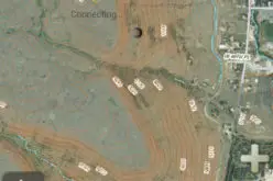
- See live demonstrations of TerraFlex and the Trimble R1 in action together, comparing the performance of the built-in GPS receiver of a smart device with that of the Trimble R1, and what it means to your data collection.
Anyone who collects information in the field is encouraged to join this webinar. No experience with the Trimble R1 or TerraFlex is necessary.
When:
- 8:00am MDT (June 24, 4:00pm Paris CEST)
- 5:00pm MDT (June 25, 9:00am Sydney AEST)
Register Now


