TerraGo Webinar: Complex 2D & 3D Map Distribution Made Easy with TerraGo GIS-Lite Applications
TerraGo Webinar: Complex 2D & 3D Map Distribution Made Easy with TerraGo GIS-Lite Applications
May 5, 2015, 12:00 – 12:30 PM ET
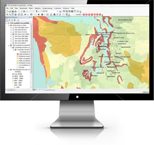 Oil & Gas companies deal with complex terrain and multi-dimensional geospatial data when inspecting and surveying pipelines. The delivery of this data to non-GIS users can be challenging, not to mention costly. Well, not anymore with TerraGo. Users can create an OpenGeoPDF that is a self-contained, lightweight GIS application and deliver an interactive, high quality map to anyone anywhere.
Join this webinar to learn how to:
- Create and deliver rich, interactive GeoPDF maps to anyone, anywhere using simple, cost-effective tools
- Combine the complexity of geospatial with the simplicity of Adobe Reader to build interactive applications
- Unleash your 3D data! 3D GeoPDF makes it easy to ship, share and show your most important assets to any user with the no cost TerraGo Toolbar and Adobe Reader
Register Now
Categories:
Webinars
Tags:
2D Map, 3D GeoPDF, 3D map, GeoPDF, map, OpenGeoPDF, Pipeline Survey, TerraGo, TerraGo GIS-Lite