Webinar on Image Centric GIS for Complete Geospatial Processing Using ENVI & ArcGIS

 Improvements in the quality and availability of geospatial imagery in recent years has driven organizations to include geospatial imagery as an integral part of their GIS strategy. While this trend has resulted in greater productivity and efficiency providing end users with better information to do their jobs, the abundance of geospatial data has also posed significant challenges. Manually sorting through multiple data types while under pressure to provide timely, accurate, and reliable information in critical circumstances is often times impossible.
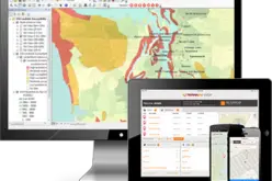
Join the free Esri India webinar to understand how ENVI & ArcGIS’s high end image centric GIS capabilities helps you to manage, process, and visualize your imagery in a quick and simplified manner without compromising the accuracy.
Key highlights
- Managing multi-sensor, multi resolution temporal image datasets maintaining original radiometry
- Enhancing your GIS using simplified but high end image analytics
- Managing, classifying and visualising LiDAR DATA
- Full Motion Video and working with Skybox video data
- Extending ArcToolbox using IDL/ ENVI program
- Accessing ArcGIS Portal from ENVI
- Image processing through Web App in ArcGIS Portal
Who should attend?
Geospatial professionals from Agriculture, Forestry, Environment, Meteorology, Space Application, Geology, Geography, Remote Sensing, and GIS
When?
Date: 30 Sept 2015
Time: 11:00 AM IST onwards
Duration: 60 minutes
Register Now