USGS Webinar: Using The National Map Services to Enable Your Web and Mobile Mapping Efforts
USGS Webinar: Using The National Map Services to Enable Your Web and Mobile Mapping Efforts
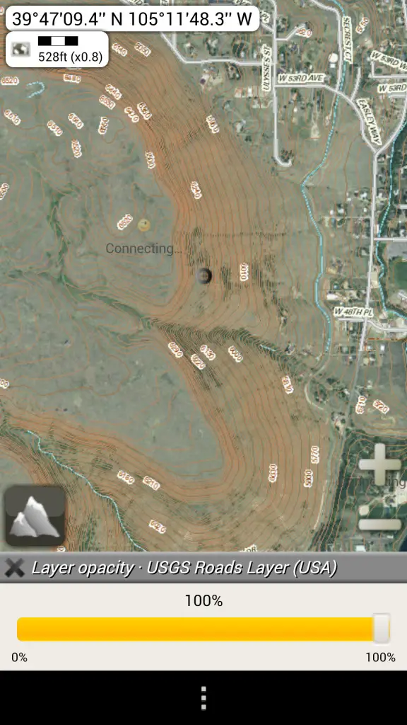
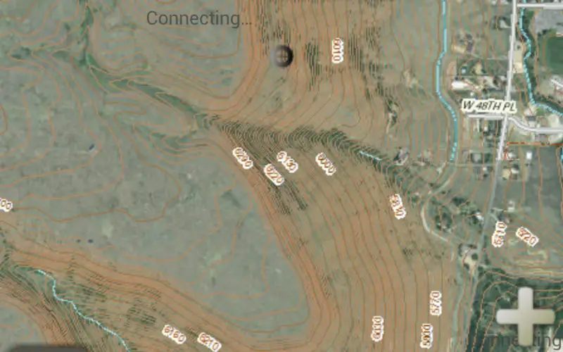
Screen shot of a mobile mapping service integrating USGS topographic data; hiking and biking trails south of Golden, Colo. Imagery with road and contour data overlaid via AlpineQuest.
Are you a developer, firm, or organization using mobile or web applications to enable your users? The USGS has publicly available geospatial services and data to help your application development and enhancement.
The USGS’ National Geospatial Technical Operations Center (NGTOC) will be hosting a 30- minute webinar on “Using The National Map services to enable your web and mobile mapping efforts” on June 16 at 9am Mountain Time.
This webinar will feature a brief overview of services, data and products that are publicly available, a quick overview on how AlpineQuest, a leading private firm, is leveraging this public data to benefit their users, and a Question & Answer session with a USGS developer to help you get the most out of the national geospatial services.
“This is an opportunity from NGTOC to bring developers and users together for some demonstrations and starting some dialogue,” said Brian Fox, the NGTOC Systems Development Branch Chief. “The webinar format allows us to improve awareness of USGS geospatial services and develop a better understanding of what users and developers need to make our data and services more available and usable.”
To access the webinar, you’ll need to activate Cisco WebEx and call into the conference number (toll free) 855-547-8255 and use the security code: 98212385. The webinar will display through WebEx, and you can access it via this address:http://bit.ly/1RHayxY
To ensure that you have the appropriate players installed for this WebEx enabled webinar: https://usgs.webex.com/usgs/
The session will be recorded and closed caption option is available during the webinar at: https://recapd.com/w-a3c704
To find out more about this and other NGOC webinar conferences, go to: http://ngtoc.usgs.gov/