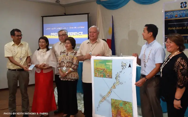
Palawan is one of the many provinces of the Philippines that benefited from the flood hazard mapping project.
The project was initiative of Department of Science and Technology’s (DOST). Recently DOST, under its Disaster Risk and Exposure Assessment for Mitigation (DREAM) project, turned over the copy of the province’s digital terrain model, digital surface model and orthophotograph to the Palawan and Puerto Princesa government.
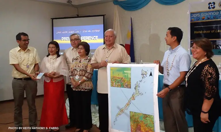
The topographic maps will be used in flood modeling of disaster-risk prone areas in Palawan, said Dr. Enrico C. Paringit, program leader of the University of the Philippines’ (UP) DREAM program. Credit: CNN Philippines
The topographic maps and other datasets will be used in flood modeling of disaster-risk prone areas in Palawan.
Dr. Enrico C. Paringit, program leader of the University of the Philippines’ (UP) DREAM program said:
“By the end of the year, we are going to complete the haphazard maps, including the flood early warning system which alerts the community six hours before flooding occurs.”
The project will target to cover 22 critical river basins across the province and since late May 2015, they completely assessed 10 river basins as follows: Babuyan, Bacungan, Candawaga, Iraan, Ilog, Iwahig, Panitian, Malatgao, Lamacan and Canipan.
“The local government will be able to use these data sets to better manage their resources in terms of, for example, preservation of forest cover as environmental sustainability in every development projects here in Palawan is important,” he suggested.
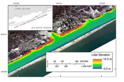
Meanwhile, the topographic three-dimensional maps were generated using a plane carrying a Light Detection and Ranging (LiDAR) instrument. It is a state-of-the-art technology that provides more detailed, up to date and high-resolution flood hazards maps through firing laser on surface it surveys.
The DREAM-LiDAR project is part of DOST’s Nationwide Operational Assessment of Hazards or Project NOAH, the country’s flagship program in disaster mitigation.