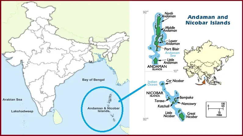
India Plans for Airborne Radar Survey of Andaman and Nicobar Islands
Speaking in Lok Sabha, Jitendra Singh Minister of State (independent charge) for Science and Technology and Earth Sciences Ministry said that the Government of India is planning to conduct an airborne radar survey to map the surface topography of Andaman & Nicobar Islands.
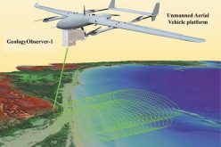
The mapping will be done by Indian National Centre for Ocean Information Services (INCOIS) and National Remote Sensing Centre (NRSC) using Airborne LiDAR Terrain Mapping (ALTM). This mapping of the strategic archipelago is proposed to carry out mapping of surface topography on the land side of the coast. This comes in the backdrop of India augmenting infrastructure and connectivity with the Indian archipelago, to implement its plans to secure the strategic advantage the islands provide in the Indian Ocean.
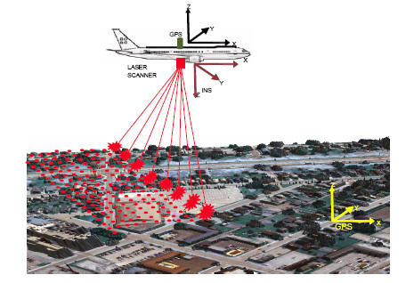
A LiDAR (Light Detection and Ranging) system beams light out and then precisely monitors the timing of reflections to map and track objects within its detection range. A LiDAR instrument principally consists of a laser, a scanner, and a specialized GPS receiver.
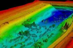
The high-resolution data on coastal topography acquired through ALTM survey is useful for modeling and assessment of the coastal inundation caused due to oceanogenic hazards such as tsunamis, storm surges, high waves, etc. This information will improve the tsunami, storm surge, and ocean state warnings generated by INCOIS.
This also comes in the backdrop of India being one of the most vulnerable countries for extreme weather events, ranking 20th on Climate Risk Index (CRI).
Better connectivity and infrastructure will help India secure its territory and protect its trade routes even as China aims to expand its naval reach. India’s only tri-service command is established in A&N at the entrance to the Malacca Strait, the world’s busiest shipping route.
India also plans to conduct airborne radar surveys to estimate the thickness of Himalayan glaciers. The pilot project for the Himalayan Glacier will be conducted at the Lahaul-Spiti basin of Himachal Pradesh.
Once the pilot project of Himalayan Glacier is done, similar studies will be conducted in Indus, Ganga, and Brahmaputra sub-basins.
Also Read –
Kochi Metro Rail Completes LiDAR Survey for Kochi Water Metro
Source – Live mint