
Tag "digital surface model"
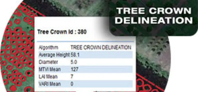
Tree Crown Delineation a New App to Monitor Trees
The latest drone app, Tree Crown Delineation automatically identifies individual tree crowns in your aerial survey. It also generates a geospatial layer of tree crowns with overall health level and

Esri Releases Drone2Map for ArcGIS
App Turns Still Imagery Captured by Drones into 2D and 3D Products Redlands, California—Drone2Map for ArcGIS, released today by Esri, turns raw still imagery from drones into professional 2D and

Webinar Series: Get More from UAV Imagery
Get More From Imagery Webinar Series: Get More from UAV Imagery Dec. 03, 2015 at 4am EDT (9am GMT) | Dec. 03, 2015 at 2pm EDT (7pm GMT) PCI Geomatics is the
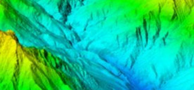
Vricon Introduces Groundbreaking Medium-resolution Digital Surface Model
November 10, 2015 – Vricon releases a medium-resolution global digital surface model (DSM) for $1.99 per km2 that defines a new industry standard for this product class. Vricon DSM-10 is
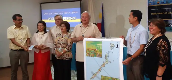
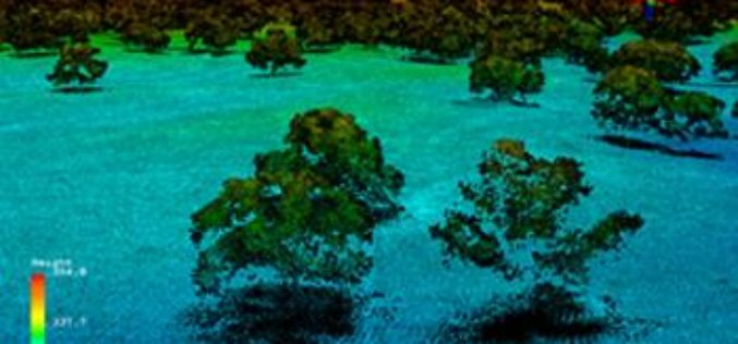
Philippines Uses LiDAR for Flood Hazard Mapping
Palawan is one of the many provinces of the Philippines that benefited from the flood hazard mapping project. The project was initiative of Department of Science and Technology’s (DOST). Recently

Who Else Want to See World in 3D
Vricon, developed as a joint venture of Saab and DigitalGlobe, Inc., is to produce data rich 3D model of world. DigitalGlobe and Saab will combine their strengths to both support and own Vricon. Saab will
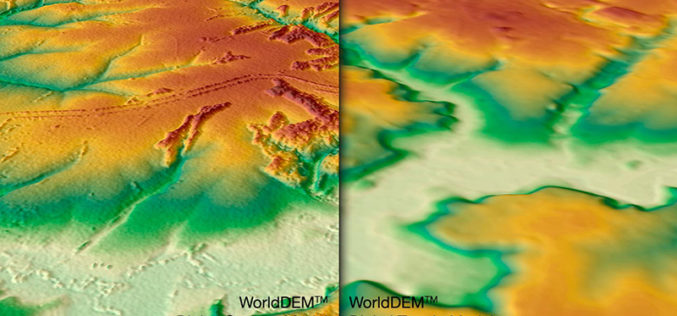
WorldDEM DTM Now Available
Precise Terrain Information Globally for Effective Analysis The WorldDEM Digital Terrain Model (DTM) is now commercially available for all users that need superior terrain information anywhere on the globe. The
Full Waveform LiDAR Sample Data Now Available For Free
In a recent announcement by NEON, NEON Airborne Observation Platform (AOP) sample data is now available on the Airborne Data page. The NEON Airborne Observation Platform (AOP) is an aircraft
