
Tag "Copernicus"
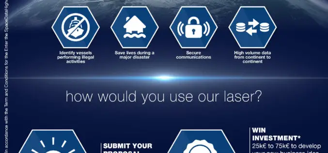
Airbus Launches “Enter the SpaceDataHighway” Challenge
• Aims to foster innovation for its brand-new laser-based space communication system. • Winner will be awarded €75,000 investment and will get support of Airbus BizLab. 12 January 2017 – Transmitting large
First Earth Colour Data Released by Sentinel-3A
20 October 2016 – The Copernicus Sentinel-3A satellite has taken another step towards being fully ‘operational’ as the first data from its Ocean and Land Colour Instrument are made available
MARSAT – Assisting the Maritime World from Space
New satellite-based services for increased safety and efficiency in shipping A new corporate network will ensure increased safety and lower costs in the field of maritime traffic in future. Five
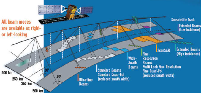
EMSA Expands Use of RADARSAT-2 Information for Maritime Applications
Richmond, BC – MacDonald, Dettwiler and Associates Ltd. (“MDA” or the “Company”) (TSX: MDA), a global communications and information company, has recently (July 13, 2016) announced that it has signed
Copernicus Thematic Workshop With Private Sector Representatives on Raw Materials and the Extractive Industries
Copernicus Thematic Workshop With Private Sector Representatives on Raw Materials and the Extractive Industries Copernicus is a user-driven programme with an important impact on different societal areas involving diverse communities
INTERGEO 2016 – Conference Programme Online
Karlsruhe, 16June 2016|“The topics being covered are as diverse as the geo community itself,” says Professor Karl-Friedrich Thöne, President of the DVW, describing the INTERGEO conference programme, which has just
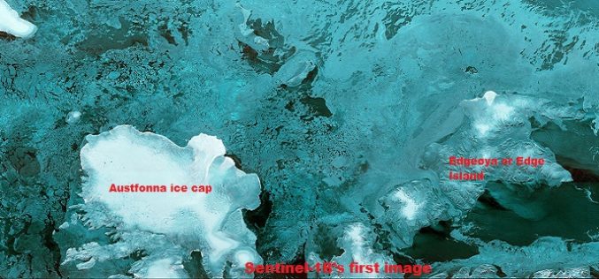
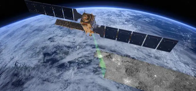
The First Images of Sentinel-1B
Launched on 25 April from Europe’s Spaceport in French Guiana, Sentinel-1B has produced its first images only two hours after the radar was switched on – a record time for
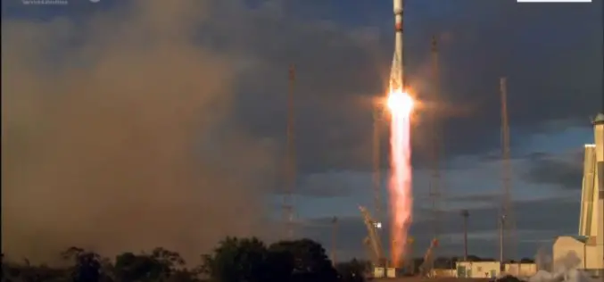
Sentinel-1B – Second Eye of the Earth Guardian in Orbit
Dual launch for European environmental satellite and MicroSCOPE small satellite mission Two eyes are better than one; this principle is also true for the two radar satellites that make up

USGS Partners with European Space Agency to Deliver Copernicus Earth Data
The U.S. Geological Survey and the European Space Agency (ESA) have established an innovative partnership to enable USGS storage and redistribution of Earth observation data acquired by Copernicus program satellites.
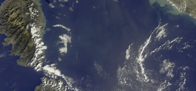
First Views of Earth From Sentinel-3
ESA– The first image from Sentinel-3A captures the transition from day to night over Svalbard, Norway, with detailed Arctic sea ice and some cloud features. Just after two weeks after
