
Tag "Copernicus"
2nd Call for Expression of Interest ‘Quantifying Risk and Recovery of Disasters’
The European Commission has launched the second call for expression of interest for a limited number of risk and recovery activations through its Copernicus Emergency Management Service for Risk &
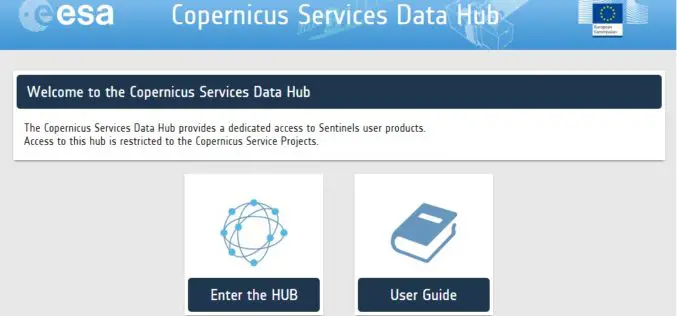
A New Sentinels Data Hub for the Copernicus Services
A new access point for the dissemination of the Sentinel products is in place for the Copernicus Service Project members: the Copernicus Services Data Hub. The Copernicus Services Data Hub initially
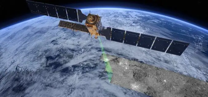
The “Radar Vision” Goes On – Two More Sentinel-1 Satellites
– Airbus Defence and Space signs €143M contract with Thales Alenia Space – New Sentinel instruments ensure services for Copernicus beyond 2029 Airbus Defence and Space, the world’s second-largest space
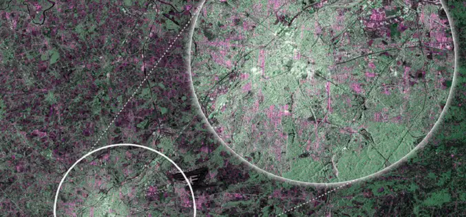
ESA Announce the Online Availability of Sentinel-2A Orthorectified Imagery
ESA is pleased to announce the availability of Sentinel-2A orthorectified products in the Sentinel Data Hub. Any products acquired from 28 November onward are available to any user. Sentinel-2 products

Earthserver Project Goes Into the Second Round
The EarthServer initiative is establishing Agile Analytics on Petabyte data cubes as a commodity Pushing the boundaries of Big Earth Data services, the intercontinental Earthserver initiative enables researchers to browse,
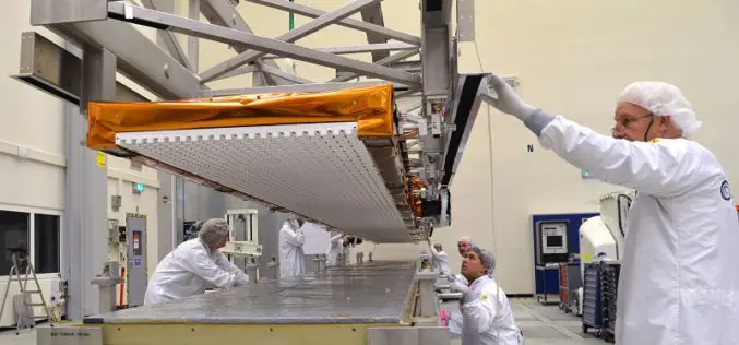
Airbus Defence and Space Delivers Sentinel-1B Radar with an Accuracy of a few Millimeters for Europe´s Copernicus Radar Satellite Mission
The Airbus Defence and Space built C-band radar instrument for the Copernicus Sentinel-1B satellite is now on its way to “meet” its spacecraft at Thales Alenia Space (TAS), Italy, the
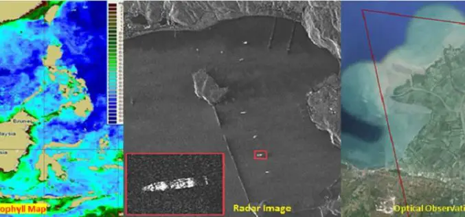
Free and Open Access to Sentinel-1 and Sentinel-3 Data Would Contribute To the Indonesian Blue Revolution
The Indonesian archipelago is one of the most important reservoirs of marine biodiversity on the planet, which makes a substantial contribution to the local fishing, aquaculture and tourism industries. Illegal
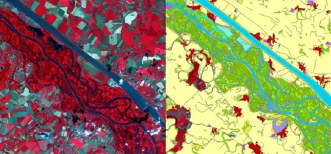
Copernicus: A Tool for Monitoring Europe’s Ecologically Sensitive River Banks
Riparian zones are fragile, yet environmentally important areas, and carry out a range of “ecosystem services”, such as filtering water, supporting wildlife and stabilising river banks. Within the Copernicus programme,
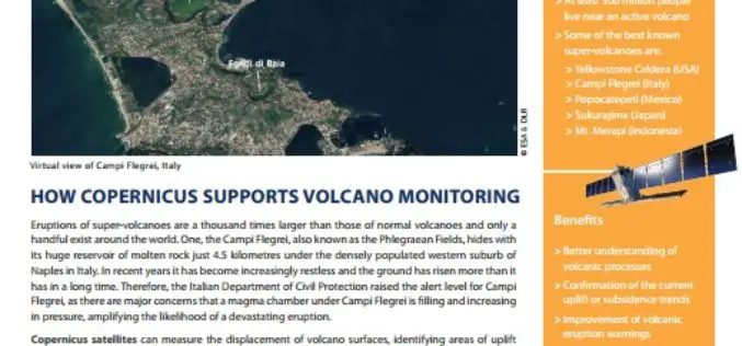
How Copernicus Supports Volcano Monitoring
Eruptions of super-volcanoes are a thousand times larger than those of normal volcanoes and only a handful exist around the world. One, the Campi Flegrei, also known as the Phlegraean
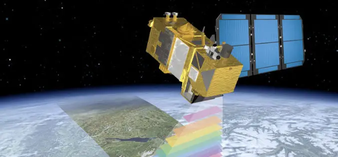
First RADAR Images of Earth by Sentinel-1A Satellite
ESA’s Sentinel-1A, kicked off on April 3, 2014, has delivered its first RADAR images of earth. ESA’s Sentinel-1A satellite will provide the ability of policymakers and service providers to access
