
Archive
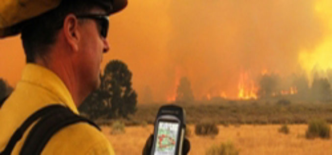
ISU, NASA Use New GIS-Satellite Imagery Program to Create Tool for Firefighters
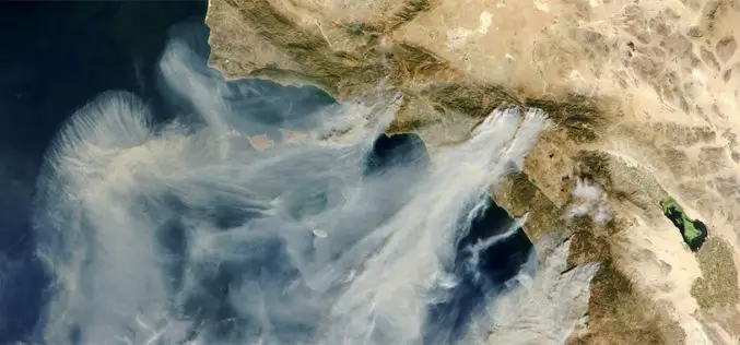
POCATELLO – 35 minutes. That’s how long it took for the Idaho State University GIS Center to produce a detailed report that gave Bureau of Land Management wildfire managers information

GIS to spur Civil Defense Response
The Civil Defense department will implement an electronic system that links its operations with houses for immediate response in events of fire. The system is already in application in Makkah and
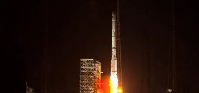
China Sends Remote-Sensing Satellite into Space
China successful sends remote-sensing satellite into space. A Long March-4C rocket carrying the Yaogan-17 satellite, blasted off from the Satellite Launch Center in Jiuquan, northwest China’s Gansu Province on Monday morning.
PhD in Geography – University of Göttingen
Degree: PhD in Geography Course Language(s): Courses are held in English (or German). Participants can choose to defend their PhD thesis in German (precondition: he/she can prove German skills (DSH 2
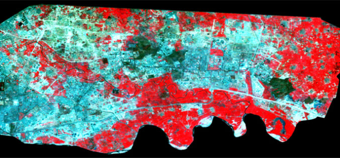
Spatiotemporal Analysis of Noida Using Remote Sensing and GIS Approaches
Spatiotemporal analysis refers to an analysis having both spatial extension and temporal duration. Remote sensing has provided a great tool to quantify changes using satellite data in our area of interest. Population
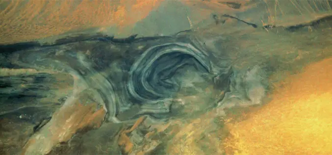
The Secrets of Lop Nor Lake
China’s “Great Ear” is the name for Lop Nor, located at the eastern end of the Tarim Basin. This name is clearly illustrated by the satellite image. The salt lake
The Breathing Earth
John Nelson has created “A Breathing Earth,” a series of animated GIFs made from NASA’s cloud-free satellite imagery of the Earth that show the oscillations of snow and greenery as the
Important Terminologies of Photogrammetry
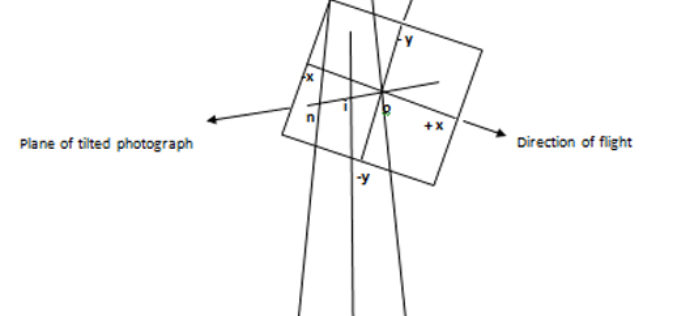
1. Vertical photograph: A photograph exposed with the optical axis of the camera coinciding with the direction of gravity or optical axis of the camera held vertical. 2. Tilted Photograph:
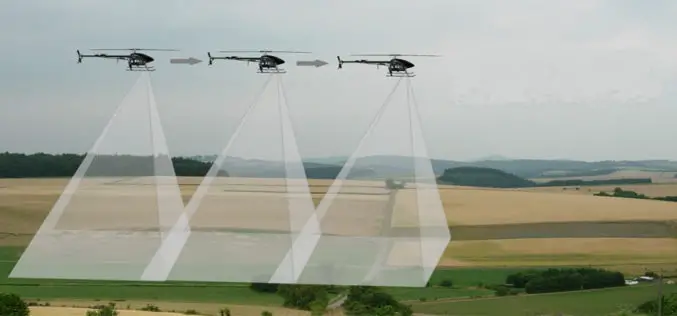
Basics of Photogrammetry
What is Photogrammetry? The classical definition of Photogrammetry is the process of deriving metric information about an object through measurement made on the photograph of the object. Photogrammetry is the
Basic Photogrammetry
The classical definition of Photogrammetry is the process of deriving metric information about an object through measurement made on the photograph of the object. Photogrammetry is the science of making
