ISU, NASA Use New GIS-Satellite Imagery Program to Create Tool for Firefighters
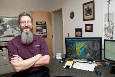
Keith Weber, ISU’s GIS Director
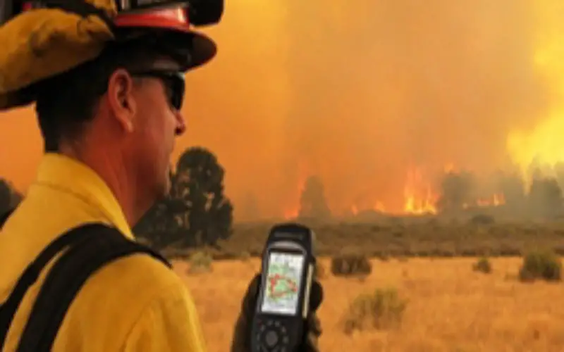
POCATELLO – 35 minutes. That’s how long it took for the Idaho State University GIS Center to produce a detailed report that gave Bureau of Land Management wildfire managers information they needed to plan for the recovery of the State Wildfire that burned on the Idaho-Utah border earlier this month – and the wildfire wasn’t even out yet.
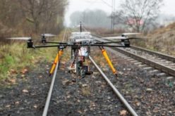
In the past, the information collected on everything from burn severity and fire intensity to slope, vegetation and soil type would have taken as long as weeks to collect and distribute. But now, using satellite imagery and a Geographic Information Systems mapping tool created by ISU GIS Training and Research Center and NASA’s Applied Sciences Program, fire managers quickly have pertinent information at their fingertips on their computers. Wildfire managers may soon also have it on their mobile devices and cell phones. ISU and NASA are working in partnership with the BLM and Idaho Department of Lands on this project.
The new program, still in its testing phase, has already been used on several Idaho wildfires, including the Pony and Elk Creek Complex Wildfire in south-central Idaho and the Mabey Fire near Bancroft.
The official name of the project is Rehabilitation Capability Convergence for Ecosystem Recovery (RECOVER). Initial funding of nearly $180,000 for this project is being provided by NASA’s Applied Sciences Program and the NASA’s High-end Computing Program.
“The RECOVER project is one of the most interesting and important activities currently funded by NASA’s Applied Sciences Program,” said John Schnase, at the NASA Goddard Space Flight Center. “We’re using a variety of advanced cloud computing, web services, and data grid technologies to dramatically improve the decision-making activities associated with fighting wildfires. We’re also setting the stage to use new types of observational data that will be produced by future NASA missions.”
Those accomplishments are gaining notice: BLM wildfire managers on the state, regional and national level have already contacted the ISU GIS Center expressing their excitement about the application.
“We’ve already had conference calls with the Washington, D.C. office and the Boise state leads,” said Keith Weber, ISU’s GIS Director. “Managers are excited about it and we just finished our test sites in June. The important people in this are the fire fighters on the ground fighting these fires, but what we’re providing is a tool to support them for their safety responding to a fire and the recovery afterwards.”
Weber and NASA would like to offer the program nationwide: for now it is being tested in Idaho.
“ISU is a national leader in remote sensing,” said Howard Grimes, ISU vice president for research and economic development. “But, most importantly, our expertise in this area serves the state and region by contributing to our ability to provide ecosystem services for managing a broad array of land and water use management issues across the state.”
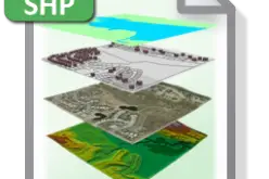
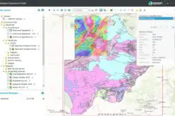
RECOVER is a computerized decision support system that is automatically deployable and site-specific. It brings together in a single application the information necessary, in the form of multi-layered GIS maps, for Burned Area Emergency Response (BAER) teams to plan reseeding strategies and monitor ecosystem recovery in the aftermath of wildfires. It is also proving useful for managers on the ground to fight wildfires while they’re occurring.
The GIS maps of fire areas are based on satellite imagery of the burned or burning areas provided by NASA and other sources. Once the ISU GIS Training and Research Center receives that imagery with the parameters of the fire, it can be processed within a few hours or sometimes, as noted above, as little as 35 minutes.
RECOVER uses state-of-the-art cloud-based data management technologies developed by NASA Goddard Space Flight Center to improve performance, reduce cost and provide site-specific flexibility for each fire. This technology is also being used in the NASA Center for Climate Simulation, which sets the stage for using climate data products in future versions of the RECOVER system.
The BLM’s policy is to have an initial Emergency Stabilization plan submitted within seven calendar days of the wildfire control date, and the complete Emergency Stabilization plan submitted within 21 calendar days to the appropriate state and/or Washington office for approval. The new RECOVER system is significantly improving the decision-making process in this tight timeframe, Weber said.
For more information on the RECOVER project, visithttp://giscenter.isu.edu/research/Techpg/nasa_RECOVER/index.htm orhttp://www.earthzine.org/2013/06/22/a-new-application-to-facilitate-post-fire-recovery-and-rehabilitation-in-savanna-ecosystems/.
More information on the NASA Applied Sciences Programhttp://appliedsciences.nasa.gov.
Source: ISU press release