
Archive

Caliper Offers Updated Mexico and Brazil Data for Use with Maptitude 2014
NEWTON, MASSACHUSETTS (USA) – Caliper is excited to announce new Brazil andMexico Country Packages! The products include a wealth of data and functionality not available in any other software. Both country packages includes
Esri and RedSeal Bring Geospatial Analysis to Network Security
Redlands, California—Esri and RedSeal Networks are joining forces to create a geospatial framework for cybersecurity. The goal is to fully integrate existing cybersecurity and information technology (IT) data with other

MAPPS to Host Webinar on UAS Section 333 Application Process
MAPPS, the national trade association for private sector geospatial firms, today announced it will host a special webinar to discuss the process to apply with the Federal Aviation Administration for
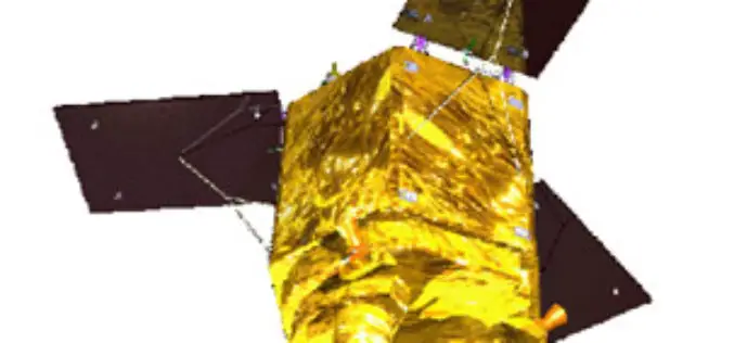
ISRO planning to launch French satellite SPOT 7 on June 26
ISRO is planning to launch its next rocket PSLV C23 carrying a French remote sensing satellite SPOT 7, along with four others from Sriharikota spaceport on June 26, a senior

GPS Fitted Vehicles Deployed on Jammu-Srinagar Highway
Police have deployed some two dozen vehicles fitted with GPS tracking devices to improve traffic management on the Srinagar-Jammu national highway, the only all-weather road linking the valley with rest
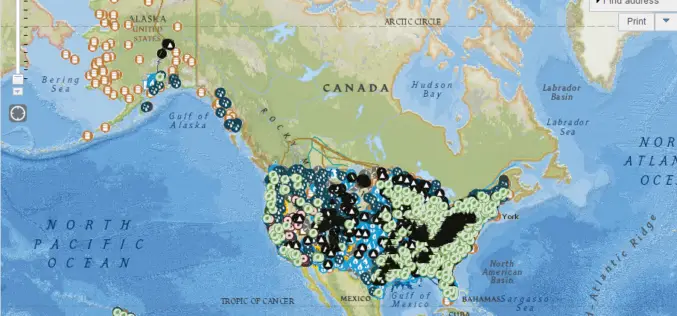
EIA’s U.S. Energy Mapping System is now Accessible on all Mobile Devices
With the 2014 hurricane season now underway, the U.S. Energy Information Administration (EIA) is making it possible for the public to track from all types of mobile devices and tablets

Uttar Pradesh Police to use GIS for Quick Response on Emergencies
In recent news, Uttar Pradesh Police will be using GIS technology to improve the efficiency of emergency emergency response and security surveillance system, in the cities of Allahabad and Ghaziabad,

NIO to so ESI Mapping to Combat Oil Spill
According to recent news, the National Institute of Oceanography (NIO) is doing a pilot study on environmental sensitivity index (ESI) mapping of oil spill to combat and subsequent formation of
Top Companies Showcase Location Analytics at Esri Business Summit
The Wendy’s Company, Miele, and JLL Lead a Powerful Lineup of Businesses Maximizing ROI with the ArcGIS Mapping Platform June 12, 2014 Redlands, California—CIOs, business managers, and IT professionals from

senseFly Announces the eBee RTK Mapping Drone – the Most Flexible Survey-grade System on the Market
Cheseaux-Lausanne, Switzerland, June 11, 2014 – Swiss mini-drone manufacturer senseFly announces the eBee RTK, the only fully integrated, fully compatible survey-grade mapping system on the market. The eBee RTK, available
