
Archive

Aligarh Muslim University is Organizing 13th IIRS Outreach Program
“Basics of Remote Sensing, Geographical Information system and Global Navigation Satellite System” 13th IIRS Outreach Program 4th August 2014 to 14th November 2014 The Department of Geology, Aligarh Muslim University

GIS Technology to Build 100 Smart Cities
According to recent news, M Venkaiah Naidu, the new Union Minister for Urban Development and Housing and Poverty Alleviation said that building 100 smart cities in country is the top most priority of
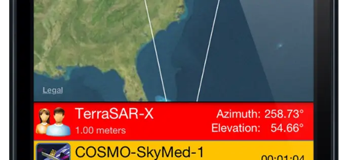
SpyMeSat Mobile App Now Offers High Resolution Satellite Imagery
Orbit Logic announced today that the iPhone version of their SpyMeSat mobile app will now offer in-app purchase of recent high resolution satellite imagery. SpyMeSat users will be able to use their
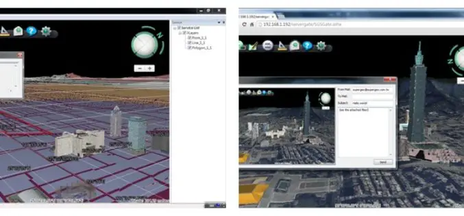
Superior 3D Map Viewing with SuperGIS 3D Earth Server Front-end Applications
To provide users a superior 3D map experience, Supergeo releases whole new front-end applications, the desktop client application, SuperGIS 3D Earth, and the browser plug-in, SuperGIS 3D Earth Plug-in, for
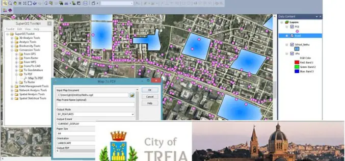
Italian Local Government Manages Urban Planning through SuperGIS Desktop
Supergeo Technologies, a leading global provider of GIS software and solutions, pleasantly announces that Urban Planning and Unique Construction Branch, Municipality of Treia, Italy selects SuperGIS Desktop to manage and
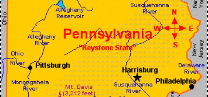
Measuring Landscape Disturbance of Gas Exploration in Nine Pennsylvania Counties
Landscape change in Pennsylvania’s Bedford, Blair, Cambria, Centre, Clearfield, Clinton, Columbia, Huntingdon, and Luzerne counties resulting from construction of well pads, new roads and pipelines for natural gas and coalbed

University of Arizona Short Course on Ore Deposits Mapping
University of Arizona Lowell Program in Economic GeologyShort Course on Ore Deposits MappingAugust 28 – September 6, 2014 University of Arizona has open registration for the tenth offering of our

PR: Esri CityEngine Increases the Power of Virtual Design
Esri’s Latest 3D GIS Design Software Makes Working with Complex 3D Urban Environments Easier and Faster Redlands, California—Esri has released CityEngine 2014, the latest version of its advanced 3D GIS urban design

MSc Studentship in SAR Remote Sensing – Cranfield University
Cranfield University is a British postgraduate and research-based university with two campuses. The main campus is at Cranfield,Bedfordshire, and the second is the Defence Academy of the United Kingdom at Shrivenham, Oxfordshire. The main campus is unique in the United Kingdom for
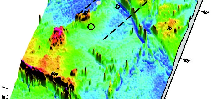
Seafloor Mapping May Help in Finding Malaysian Airlines MH370
According to the two world’s leading ocean floor mapping experts, come up with a new illustration of the seafloor with details underwater terrain where the missing Malaysia Airlines flight might
