
Archive
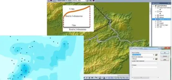
SuperGIS is Selected for Public Infrastructure in Nepal
Supergeo Technologies, the global leading GIS software and solution provider, announces that Rajdevi Engineering Consultant utilizes SuperGIS Desktop, SuperGIS Spatial Analyst and SuperGIS 3D Analyst in several governmental public infrastructure

eCognition Essentials-Powerful Out-of-the-Box Land Cover Mapping Solution
eCognition Essentials is a new software solution for geospatial and remote sensing professionals performing land cover mapping tasks using imagery. eCognition Essentials offers an intuitive image analysis solution that allows users
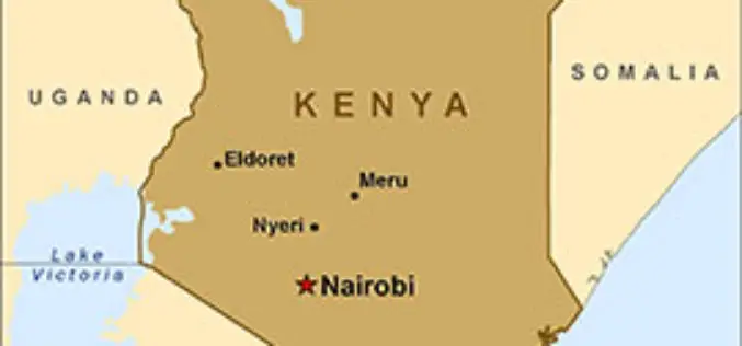
Geospatial Technology for National Planning
In recent news, Kenya is planning to use geospatial technology in its national planning process to facilitate governance. Cabinet Secretary in the Ministry of Devolution and Planning Anne Waiguru told

USGS-NASA Award Recognizes Innovations in Earth Observation
A pioneer in mapping global land cover change and the team behind the United States’ most advanced land surface mapping satellite have both been honored with the 2014 William T. Pecora

Vietnam Completes Spatial Database of Entire Territory
According to news published in Vietnamnet, Vietnam has completed the spatial database of country’s entire territorial waters, including Hoang Sa (Paracel) and Truong Sa (Spratly) archipelagos. The database have multi-temporal satellite

Ten Ways Remote Sensing Can Contribute to Biodiversity Conservation
WCS, NASA, And other conservation and remote sensing agencies, universities and NGOs focus on top 10 conservation questions for satellite technology Remote sensing has and can continue to play a

Mapping Switzerland’s Danger Spots
A Landslide In Southern Switzerland Has Left Two Dead. The Area Hadn’t Been Included In National Danger Zone Maps. A wall above the property apparently collapsed after days of heavy

PhD in GIS and Remote Sensing at Motilal Nehru National Institute of Technology
Motilal Nehru National Institute of Technology Allahabad [MNNIT Allahabad], an Institution of National Importance declared by the Act of Parliament and a premier technical institution of the Country, offers several
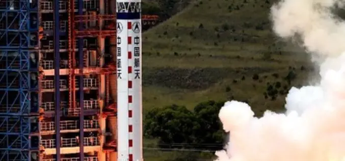
China Launches New Remote Sensing Satellite
In recent news,China has successfully launched a Yaogan-23 remote sensing satellite into scheduled orbit that will help in scientific experiments, natural resource surveys, crop yield estimates and disaster relief measures. The
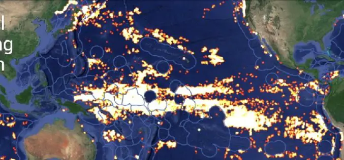
Global Fishing Watch Using Mapping Technology
Global Fishing Watch is the product of a technology partnership between SkyTruth, Oceana, and Google. Global Fishing Watch is a technology platform that uses satellite data to inform the public
