
Archive
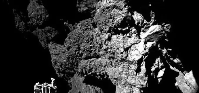
ESA Rosetta’s Philae Probe Lands on Comet
ESA’s Rosetta mission has soft-landed its Philae probe on a comet, the first time in history that such an extraordinary feat has been achieved. After a tense wait during the
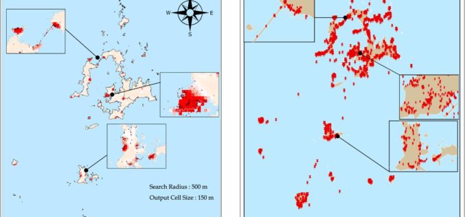
Tag at Hot Tourist Spots with GIS
Tourism management is highly relevant with locations, so GIS is useful to find out better solutions. However, traditional research consumes a lot of time on data collecting, and is limited
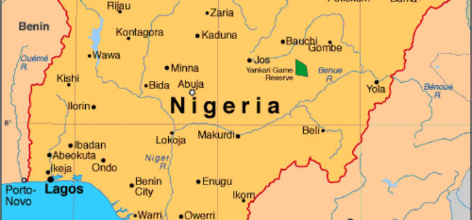
Government of Nigeria to Use Space Technology to Tackle Environmental Challenges
According to WorldStage Newsonline, The Federal Government of Nigeria is set to reposition space technology to tackle environmental challenges. Director of the National Centre for Remote Sensing (NCRS), Mr. Effron

TomTom Revolutionises the Way Maps Are Delivered
MultiNet-R enables customers to deliver maps to the market faster and easier Amsterdam, 12 November 2014 – TomTom (TOM2) today announces the availability of MultiNet-R, a new and innovative

Webinar: Using GPS with Global Mapper
Using GPS with Global Mapper November 20, 2014 at 11:00 am (EST) Over the last decade, GPS positioning technology has become increasingly ubiquitous. It is built into our cars, our
Gartner Names GE a Leader in “Magic Quadrant” Report for Utilities Geographic Information Systems
Digital Energy business today announced that it has been named as one of the industry’s leading solutions provider of Utilities Geographic Information Systems software. This was announced in a recent

Environment Ministry Launches GIS Based Online Support Mechanism
Aimed at bringing transparency and reduce delays in regulatory clearances, the environment ministry today launched the Geographical Information System (GIS) based online support mechanism to help in taking

PhD in Earth Observation and Remote Sensing at The University of Tromsø
The University of Tromsø – The Arctic University of Norway. Located in the city of Tromsø, Norway, it was established in 1968, and opened in 1972. It is one of eight

Exprodat Supports Geothermal Resource Exploration at Utah State University
Exprodat, the oil and gas GIS services, software and training supplier has provided the Geology Department at Utah State University (College of Science) with licenses of their popular Exploration Analyst and Data Assistant extensions to Esri’s
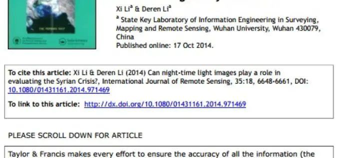
Can Night-time Light Images Play a Role in Evaluating the Syrian Crisis?
Can night-time light images play a role in evaluating the Syrian Crisis? Xi Lia & Deren Lia a; State Key Laboratory of Information Engineering in Surveying,Mapping and Remote Sensing, Wuhan University, Wuhan 430079,China
