
Archive

New Autonomous Flying Drones Don’t Require GPS to Navigate
Scientists have developed a new drone navigation system that allows these aerial vehicles to navigate without relying on a GPS signal or trained personnel. With the goal of achieving autonomous
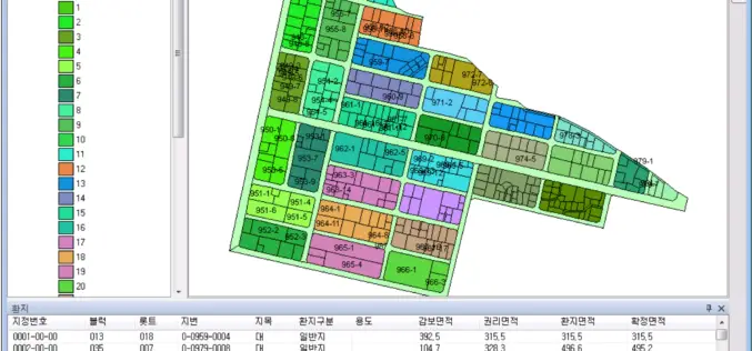
Korea Develops Land Management System by SuperGIS Engine
To meet the demands of global GIS professionals and developers, Supergeo provides with SuperGIS Engine 3.3, the COM-structured development kit, bringing various GIS developing elements, application resources and sample modules

Ordnance Survey becomes a Strategic Member of the Open Geospatial Consortium
Ordnance Survey (OS) is pleased to announce that it has raised its Open Geospatial Consortium (OGC) membership level to become the first Strategic Member outside of the USA Ordnance Survey (OS) joins the

3D Printing to Illustrate Agricultural Potential of Farmlands
The Department of Agriculture and Food, Western Australia has moved on next step with 3D printing of farmlands for clear illustration of agricultural potential of lands. The 3D printing is also

The 5 Most Viewed UAVs for Mapping and 3D Modelling on Geo-matching.com
The Geo-matching.com website features a selection of the most important geomatics equipment, including UAS for Mapping and 3D Modelling. At www.geo-matching.com you can compare product specifications and read users’ reviews

Airbus Defense and Space and Hexagon Geospatial Partner to Provide Access to Data in Smart Applications
May 26, 2015 – Airbus Defense and Space and Hexagon Geospatial have partnered in a new content-sharing program that will enable end-users to have access to Earth Observation data and software

Nominations Open for the Prestigious Carl Pulfrich Award 2015
Heerbrugg, Switzerland, 26 May 2015 – Hexagon Geosystems is pleased to continue the tradition of promoting outstanding scientific, application-oriented design and/or manufacturing activities in the field of photogrammetry, remote sensing
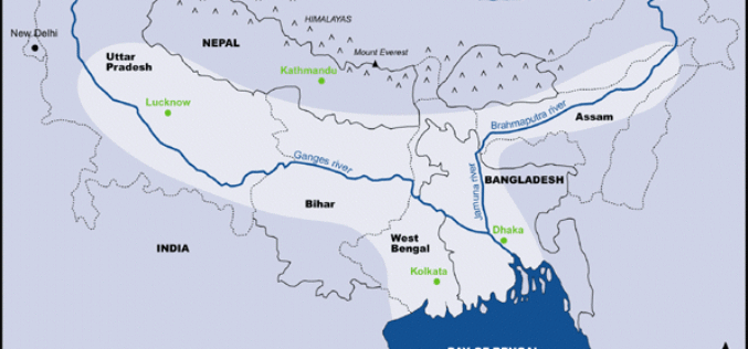
Ganga-Bramhaputra Basin Mapped In First of Its Kind Study
The Ganga-Bramhaputra Basin together store around 960 cubic km of water, researchers have claimed in a first of its kind study after mapping the rivers, and said it will help

FOSS4G Seoul 2015 Committee signs MOU with Smart Geospatial Expo 2015 Organizing Committee
FOSS4G Seoul 2015 Committee is pleased to announce to sign Memorandum of Understanding (MOU) with Smart Geospatial Expo Organizing Committee to closely cooperate FOSS4G Seoul 2015 and SmartGeo Expo 2015
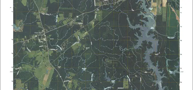
Louisiana Quads Add Trails and Survey Data
Newly released US Topo maps for Louisiana feature select trails and other updates Several of the 812 new US Topo quadrangles for Louisiana now display public trails along with improved
