
The academic earth imaging community is encouraged to submit nominations for the prestigious Carl Pulfrich Award.
Heerbrugg, Switzerland, 26 May 2015 – Hexagon Geosystems is pleased to continue the tradition of promoting outstanding scientific, application-oriented design and/or manufacturing activities in the field of photogrammetry, remote sensing and earth imaging applications.
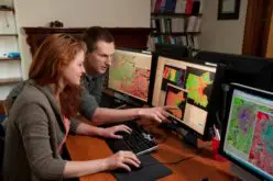
The academic earth imaging community is encouraged to submit nominations for this prestigious award. Nominees will be considered on the basis of experience, activities in field of photogrammetry and remote sensing, and contributions to the advancement of all aspects of the earth imaging field. Applied work involving hardware systems, software solutions, or innovative service activities will be considered as well.
The award recipient(s) will receive a monetary gift of $7,500 (U.S.) or an amount deemed suitable by the award council and will be presented the distinguished 2013 Carl Pulfrich Award Plaque during the 54th Photogrammetric Week, Sept. 9-13, 2013, in Stuttgart, Germany.
For more information about the award and the criteria, please visit:
http://www.leica-geosystems.com/carlpulfrichaward or http://www.ziimaging.com/carlpulfrichaward
Carl Pulfrich Award
The biennial award and donation is intended to honor the memory of Dr. Carl Pulfrich, a member of the scientific staff at Carl Zeiss from 1890 to 1927, during which time he directed the design of the first stereo photogrammetric and surveying instruments from Zeiss.
Leica Geosystems – when it has to be right
Revolutionising the world of measurement and survey for nearly 200 years, Leica Geosystems creates complete solutions for professionals across the planet. Known for premium products and innovative solution development, professionals in a diverse mix of industries, such as aerospace and defence, safety and security, construction, and manufacturing, trust Leica Geosystems for all their geospatial needs. With precise and accurate instruments, sophisticated software, and dependable services, Leica Geosystems delivers value every day to those shaping the future of our world.
Leica Geosystems is a brand within Hexagon Geosystems, the complete reality-capture solutions provider. With a sharp focus on information technologies that capture, measure, and visualise data, Hexagon Geosystems’ high-quality products and solutions create real digital worlds.
Leica Geosystems is part of Hexagon (Nasdaq Stockholm: HEXA B; hexagon.com), a leading global provider of information technologies that drive quality and productivity improvements across geospatial and industrial enterprise applications.
For further information please contact:
Dr. Hartmut Rosengarten
Director Airborne Sensors EMEA
Z/I Imaging GmbH
Ziegelstraße 12,
D-73431 Aalen, Germany
Phone: +49 (0)7361 8895 4520
e-mail: hartmut.rosengarten@hexagongeosystems.com
or
Leica Geosystems AG
Konrad Saal
Heinrich-Wild-Strasse
CH-9435 Heerbrugg
Tel.: +41 (0)71/727-3511
Fax: +41 (0)71/726-5511
konrad.saal@leica-geosystems.com