
Archive
SuperSurv for iOS Selected by Kebangsaan University, Malaysia for Academics and Training
Supergeo Technologies, the global GIS software and solution provider, announces that Kebangsaan University, Malaysia selects SuperSurv for iOS for its civil engineering and environment building research and training quality. As
The 5 most viewed UAVs for Mapping and 3D Modelling on Geo-matching.com
The Geo-matching.com website features a selection of the most important geomatics equipment, including UAS for Mapping and 3D Modelling. At www.geo-matching.com you find product specifications, videos, brochures and more. Geo-matching.com
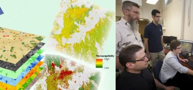
A Landsat based Tool to Map Wildfire Hazard and Susceptibility
Wildfires, coupled with the presence of invasive plant species, are primary drivers of change in semi-arid savanna ecosystems. These wildfires disrupt ecosystems, human localities, critical habitats of the endangered Greater

TerraGo Edge 3.7 Enhances Forms and Expands High Precision GPS/GIS Integration
TerraGo Edge 3.7 Enhances Forms and Expands High Precision GPS/GIS Integration September 15, 2015 12:00 – 12:30 PM ET The latest release of TerraGo Edge further expands integration with GIS

ARSET Training Announcement: Remote Sensing for Wildfire Applications
Remote Sensing for Wildfire Applications (in-person workshop) October 6-8, 2015 Idaho State University, Pocatello, Idaho, USA Workshop Overview: The ARSET team is gearing up for an in-person training titled “Remote
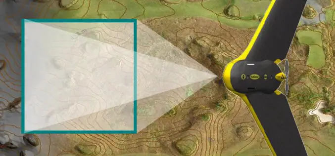
Drones to Access Crop Condition and Farming Possibilities
Drones in agriculture have transformed the way of capturing remotely sensed data and have proven their capability in many other domains. With the capability of acquiring high resolution data (spatial, spectral,

Webcasts: Creating Digital Terrain Models with ImageStation DTM for GeoMedia
Creating Digital Terrain Models with ImageStation DTM for GeoMedia Accurate and up-to-date elevation data layers provide the foundation for a wide variety of applications, from urban change detection to transportation

Lectures by Experts – 55th Photogrammetric Week
Welcome at the 55th Photogrammetric Week Sept. 7 – 11, 2015, at the University of Stuttgart The Institute for Photogrammetry of the University of Stuttgart and the OpenPhoWo partners would

French Energy Company SPIE chooses SuperPad To Enhance Survey Efficiency
Supergeo, the total GIS software solution provider, announces that SPIE, France, chooses SuperPad, the mapping application designed for Windows Mobile,to empower its streetlights and other utilities survey works. SPIE, the
ASPRS Launches Lidar Certification
The American Society for Photogrammetry and Remote Sensing (ASPRS) certification program announces the launch of a Professional and Technologist LIDAR Certification, the Certified Mapping Scientists, Lidar (CMS, Lidar) and the
