
Archive

Digital Mapping of Alaska Completed Halfway
As reported in Alaska Dispatch News, Alaska is one-fifth the size of the U.S. and covered with treacherous terrain, because of which creating map of such areas is quite difficult in
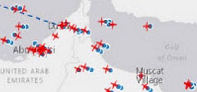
Esri and FlightAware Partner for Extensive Flight Tracking and Status Data Mapping Initiative
World’s Largest Flight Tracking Company FlightAware Makes Its Data Available in Market-Leading ArcGIS Mapping Platform Redlands, California—Esri and FlightAware have partnered to combine the power of the world’s leading flight

Aircraft Likely To Be Used For Mapping Ganga Basins to Rid It of Pollution
Fitted with powerful cameras, Special Purpose Aircraft may soon fly over the Ganga to survey the river as it courses through five states for a geospatial mapping of its basin

UN Special Session program at FOSS4G Seoul 2015
The FOSS4G Seoul 2015 Organizing Committee is pleased to announce the final program of “Open Source GIS for UN and Developing Countries” Special Session at FOSS4G Seoul 2015. This session
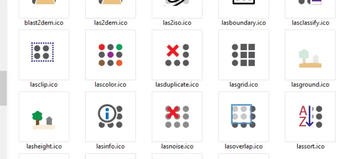
LAStools Toolbox now also for ERDAS IMAGINE 2015
The August release of LAStools from rapidlasso GmbH now also contains a toolbox for the latest 15.1 version of ERDAS IMAGINE® 2015 from Hexagon Geospatial. The two companies had announced their cooperation earlier this year after releasing

Volumetric Computation Workflows with Trimble Business Center
TBC Power Hour Webinar Series Volumetric Computation Workflows with Trimble Business Center August 26, 2015 Surface creation and volume computation in Trimble Business Center enables you to efficiently manage, inspect
University of North Alabama Online GIS Analyst Certificate Program
The University of North Alabama (UNA) is a coeducational university located in Florence, Alabama, and the state’s oldest four-year public university. The University of North Alabama, which celebrated its 175th anniversary

Trimble Announces Expanded Share Repurchase Program
SUNNYVALE, Calif., Aug. 13, 2015—Trimble (NASDAQ: TRMB) today announced that its Board of Directors has approved the repurchase of up to $400 million of Trimble’s common stock and that it
Hexagon Geospatial Automates Property Change Assessments in ERDAS IMAGINE
Files Patent for New Property Change Assessment Innovation for Growing Base of ERDAS IMAGINE Users Hexagon Geospatial is pleased to announce it has filed a patent for a new, fully
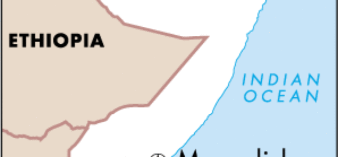
Remote sensing, Satellite Imagery, Surveys Use to Estimate Population of Mogadishu
The results of the first population survey of Mogadishu, Somalia, conducted in a quarter century were presented today at a session of the 2015 Joint Statistical Meetings (JSM 2015) in
