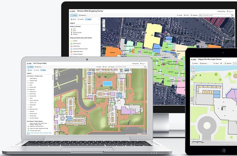
Esri has released the November 2015 update for ArcGIS Online features, which includes new options for visualizing your data, enhancements to administering your organization, and improvements to the design of the website.
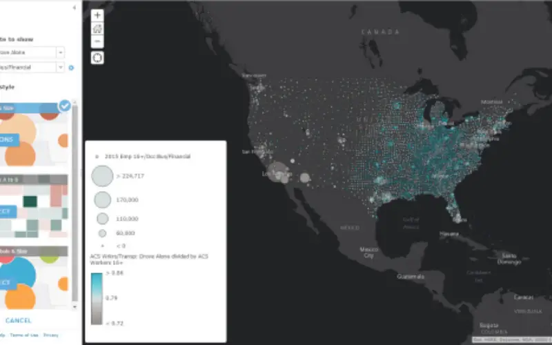
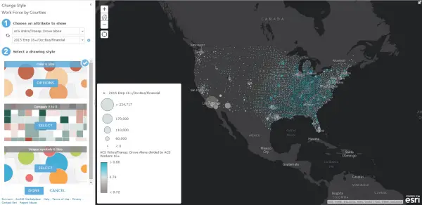
Now do Smart Mapping with new map styles that illuminate multiple attributes in your data. These new styles help you make your maps more attractive, and smarter. These new styles help you by doing the calculations you need behind the scenes so you can focus on what map you want to make.
- A new style called Color & Size allows you to map the relationship between two numbers such as poverty rate and a number of single-parent households. See an example.
- A new style called Unique symbols & Size allows you to map a count attribute, See an example.
- A new style called Compare A to B allows you to map the ratio between two numbers and express that relationship as percentages or simple ratios.
Vector tile layers
This release of ArcGIS Online introduces initial support for vector tile layers as a layer in a web map. A vector tile layer references a set of web-accessible vector tiles and the corresponding style for how those layers should be drawn. Vector tiles are similar to image tiles, but they store a vector representation of the data. Client-side drawing of vector tiles allows for vector tile layers to be customized for the purpose of the map and drives dynamic, interactive cartography.
Administration
Administrators now have an additional tool for assigning a flexible allocation of credits to some or all organization members that have access to services that use credits. Within this new Credits tab, Esri-defined Administrators can manage credit expenditures by members by allocating credits to them based on their needs. This new feature can be used to manage expenditure on the most common services that individuals directly consume, including batch geocoding, network analysis, geoenrichment, demographics, and tile generation.
ArcGIS Online now supports encrypted Security Assertion Markup Language 2.0.
Apps for Everyone
- Web AppBuilder for ArcGIS
- ArcGIS Open Data
- ArcGIS Marketplace
- Collector for ArcGIS
- Operations Dashboard for ArcGIS
- Navigator for ArcGIS
- Esri Maps for SharePoint
- Survey123 for ArcGIS (Beta)
Scene Viewer
- reate and view local scenes that display content in any projected coordinate system. Visualize your data in a smaller or local extent, clip your scene, and navigate underground.
- Collaborate on scenes within your organization through update item capabilities.
- Experience the starry sky at night and watch the sun rise and set on your scenes.
- Add outlines to point symbols options for color, width, and transparency.
ArcGIS Content
Get additional levels of detail in the tiling scheme to support larger scale data in or on the basemap for World Imagery, World Street Map, and World Topographic Map. Find updates to reference layers with recent data for North America. Access demographic maps with current data for more than 20 countries, including Canada.
Read more at: http://goo.gl/FKYbYy