
Archive
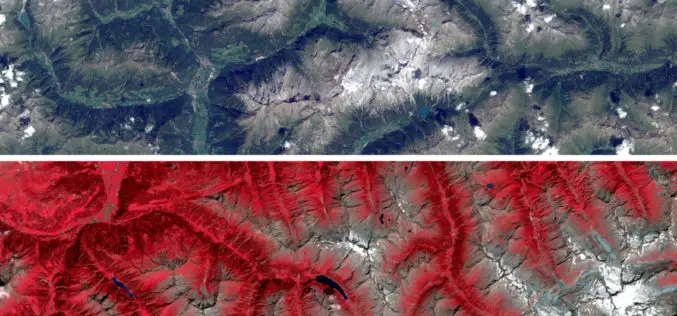
Sentinel Imagery Now Works Inside ArcGIS
Redlands, California—Esri enhanced its ArcGIS technology to simplify the use of free global imagery from the Sentinel-2 satellite launched by the European Space Agency. ArcGIS supports visualization, interpretation, and analysis
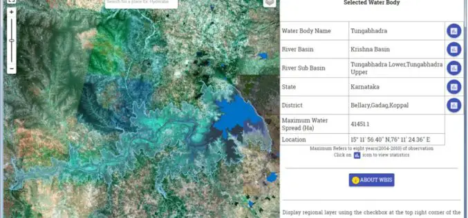
Temporal Repetitive Mapping of Water Bodies Across India
National Remote Sensing Centre (NRSC), ISRO at Hyderabad monitors the status of all the water bodies in the country using satellite images and provides water spread area information on a
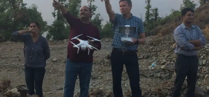
Drones Against Natural Disasters
In June 2013, the Himalayan state of Uttarakhand experienced severe flooding and landslides, resulting in a catastrophic natural disaster. An Indo-Norwegian cooperation project now provides technical support for mitigating disasters

Upgrade Your Work Efficiency by GIS Complete Solution of Supergeo
The product team of Supergeo is continually striving to develop various GIS software to pursue the latest trend in the geospatial industry. Corresponding to the advancement of hardware and various

Apple to Unveil Maps Centre in Hyderabad
Hyderabad, India: Apple CEO Tim Cook will inaugurate its development centre on 21 May,216 in the presence of Telangana Chief Minister K Chandrasekhar Rao. The California-based technology giant, which manufactures

“India Should Build Its Own Space Station”
India should actively get into building its own space station in the Low Earth Orbit (LEO) as its next space frontier since the time is opportune for this, a retired
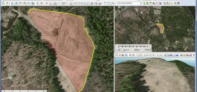
Global Mapper 17.2 Released with New Map Book Creation Tool and Cutaway Terrain View
Hallowell, Maine – May 17, 2016 – Blue Marble Geographics (bluemarblegeo.com) is pleased to announce the immediate availability of Global Mapper version 17.2. This upgrade to the version 17 release
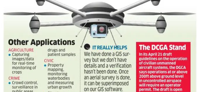
Bengaluru Civic Corporation to Use Drones for Mapping Property & Taxes
India-According to recent news, Bengaluru civic corporation is all set to use unmanned aerial systems (UAS), commonly known as drones, to map urban properties and property taxes. This could help the

Pakistan Express Serious Concern Over India’s Geospatial Bill
According to recent news by The Economics Times, Pakistan has expressed serious concern to the United Nations Security Council (UNSC) over the depiction of Jammu and Kashmir in India’s draft geospatial

New 3D Modelling Application to Save Money and Time
The most accurate and up-to-date geographic data now available for the first time in new application suitable for BIM projects. OS Model Builder is a new visualisation tool that can
