
Archive
How Do I Choose the Right Image-capture Settings for 3D Models?
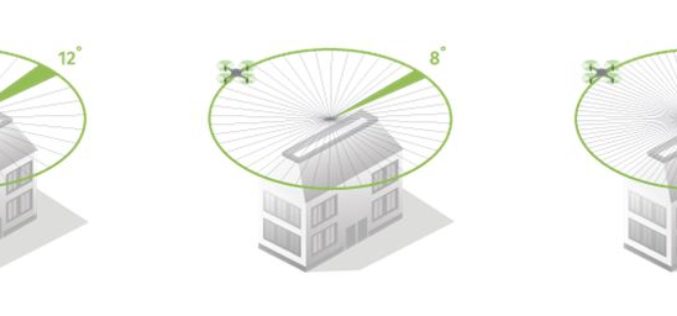
How do I choose the right image-capture settings for 3D models? What are the effects of the “angle between images” setting in circular missions when it comes to 3D reconstruction?

Swarms of Drones to Map Oil Spill
In a recent news released by the University of Buffalo, inspired by birds and insect behavior soon swarms of flying drones will be mapping oil spills. Souma Chowdhury, Assistant Professor, Department of
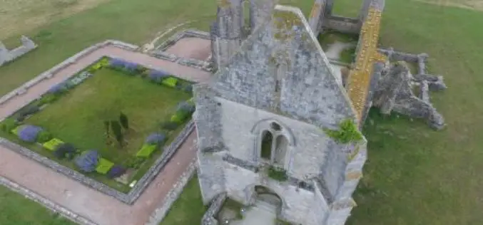
Leveraging 3D Modeling and Printing Skills as a Service: Mapping the Abbey of Chateliers and Church of Ars-en-Ré
In order to explore how to better expand and improve their services, French photography and photogrammetry-based service provider Unautregard teamed up with Planète Sports &Loisirs and 3D Arcwest, to capture,

Skymet Tackles Perils of Agriculture Climate Change
Skymet is India’s foremost private and largest weather monitoring and agriculture risk Solutions Company, expert in measuring, predicting and limiting climate risk in agriculture, disaster management and energy. Over the

Airbus Partners with Bird.i for Easy Access to Fresh Earth Observation Imagery
Toulouse, 27/02/2017: Airbus Defence and Space has closed a partnership agreement with Bird.i, a global platform for accessing the world’s best satellite, airborne and drone imagery. Objective of the partnership
