
Archive

SuperGIS Webinar: SuperPad 10, Taking Mobile GIS to a New Level
SuperGIS Webinar: SuperPad 10, Taking Mobile GIS to a New Level 10:00 AM (GMT+2) | Wednesday, March 22, 2017 | Your local time The next generation of mobile GIS is here! New
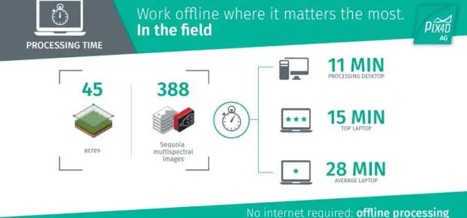
The Power of Offline Processing: Why Desktop is Essential for Drone Mapping in Agriculture
Part 2: Processing in the Field In Part 1 of this mini-series we went over why it makes sense in agriculture to import images directly to Pix4Dag Desktop. We concluded that
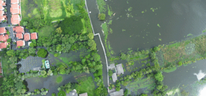
GIS & Decision Support Scenarios to Mitigate the Impact of Urban Flooding
A short spell of rain is enough to create chaos on roads in most urban areas in cities. Assurances by local authorities about preparedness to meet exigencies arising
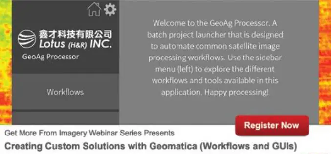
PCI Geomatica Webinar Series: Creating Custom Solutions with Geomatica (Workflows and GUIs)
Creating Custom Solutions with Geomatica (Workflows and GUIs) Asia and Australia – March 23/2017, 10AM TAIPEI (GMT +8) North America and Europe – March 23/2017 – 10AM TORONTO (GMT-4) No one problem is the

Trimble and Ordnance Survey Collaborate to Aid Geospatial Industry Innovation
An exciting new relationship between Trimble and Ordnance Survey (OS) sees innovators at the Geovation Hub leverage Trimble’s latest technologies. Innovators at Ordnance Survey’s Geovation Hub, a group ranging from Big Data

OGC Seeks Public Comment on proposed Unmanned Systems Domain Working Group
The Open Geospatial Consortium (OGC®) seeks comments on the draft charter of a proposed Unmanned Systems Domin Working Group (UXS DWG). The proposed DWG will provide an open forum for

Supergeo Announces the Official Release of SuperPad 10
Integrating GNSS and GIS technologies, SuperPad 10 is mobile GIS software designed for Windows and Windows Mobile OS. As one of the most popular mobile software of Supergeo, SuperPad not

NCTech ColourCloud Processing Now Hosted on Google Cloud Platform
ColourCloud to harness Intel Skylake processing power for 3D depth and image data San Francisco, CA – March 10, 2017 – NCTech, the developer of reality imaging systems, today announced
OGC Calls for Public Review of Proposed Common Object Model Container Standards Working Group
March 09, 2017 – The Open Geospatial Consortium (OGC®) request comments on the draft charter for an OGC Common Object Model Container (COMC) Standards Working Group (SWG). The core philosophy behind the
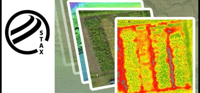
PCI Geomatics Releases STAX for UAV
MARKHAM, Ontario, Canada — March 07, 2017: PCI Geomatics, a world-leading developer of remote sensing and photogrammetric software and systems, announced today that it has released a new UAV image
