
Archive

Trimble Expands CenterPoint RTX FAST Correction Service in North America and Europe
Delivers High-Accuracy, Real-Time GNSS Corrections in as Fast as One Minute SUNNYVALE, Calif., Nov. 13, 2017—Trimble (NASDAQ: TRMB) announced today the expansion of its CenterPoint® RTX Fast (RTX Fast) correction

AppStudio version 2.1 for ArcGIS is Now Available
Esri’s AppStudio for ArcGIS is a pioneering tool in the GIS app development. It helps to create simple maps into beautiful mobile app friendly ready for various mobile operating systems such as iOS, Android, Windows etc, with no developer skills required.
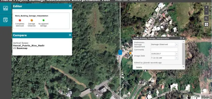
Esri Provides Mapping Technology for Students to Assess Hurricane Damage
Schools Can Use High-Resolution Imagery to Identify Where Help Is Needed to Rebuild in Puerto Rico November 9, 2017, Redlands, California – Esri, the world leader in spatial analytics, today announced it
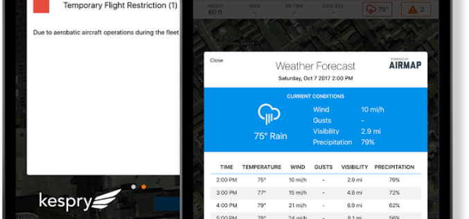
AirMap and Kespry Partner for Safe, Compliant Drone Flights
New integration brings AirMap airspace intelligence to the Kespry platform for automated drone operations Santa Monica, CA (November 9, 2017) – AirMap and Kespry has announced a partnership that brings AirMap’s best-in-class airspace intelligence, including airspace

UAV can be Effectively Used in Disaster Management: NDMA
New Delhi, Nov 7, 2017 (PTI) – Unmanned aerial vehicles (UAVs) can be effectively used in disaster management, the National Disaster Management Authority (NDMA) today said. “UAVs can provide high-resolution,

Woolpert Contracted for $1.7M University Field House
The firm was contracted by Mecklenburg County to design this shared facility that will benefit both county residents and students at Queens University. CHARLOTTE, N.C. (Nov. 3, 2017) — Woolpert

Launch of China’s New-Generation Beidou-3 Navigation Satellites
November 5, 2017 – According to recent news, China has successfully launched two navigation satellites – namely the Beidou-3M1 (Beidou-24) and Beidou-3M2 (Beidou-25) navigation satellite using a Long March-3B/YZ-1 rocket. The satellites are

Disaster Management Authorities to Get a New Tool to Handle Tsunamis
According to recent news by the First Post, Disaster management authorities are all set to get a new tool to handle tsunamis. They will be able to know how far the

Bluesky LiDAR Data Used by RPS to Assess Flood Risk for Anglian Water
November 1, 2017 – A sewer flood risk map of the Anglian Water region is being created by the Wastewater Consultancy team of RPS. The highly accurate 3D digital map

Government of India Issues Draft Norms For Using Drones
New Delhi, Nov 1 (PTI) – After long drawn discussions, the civil aviation ministry today unveiled draft norms for operating drones for civilian purposes in the country. The Unmanned Aerial
