
Archive

UP42 Webinar on Fusion of Satellite Imagery, AIS Data, Machine Learning for Maritime Surveillance
UP42, creator of the leading developer platform for Earth observation data and analytics, will host a free webinar on maritime monitoring and surveillance on Dec. 9, 2020. Presentations will discuss
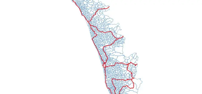
OSM Kerala Community Releases Local Body Boundary Map of Kerala
Recently OSM Kerala Community has released a free Local Body boundary map of Kerala. The data have map boundaries added for Corporations, Municipalities, and Gram Panchayat. As part of Kerala
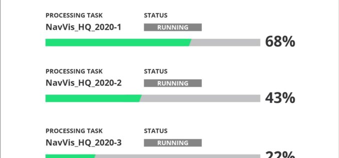
NavVis Introduces Cloud Processing for Even Faster Laser Scanning Workflows
From processing to viewing, with NavVis it can now be done entirely in the cloud. NavVis, an innovator in indoor mobile mapping, today introduced the Cloud Processing Add-on for NavVis
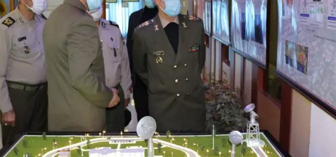
Iranian Defense Ministry Unveils Military Geographic Products
Tehran – The Iranian Defense Ministry unveiled new products and systems related to geographic data and information for military purposes. In a ceremony held in Tehran on Monday morning, Defense
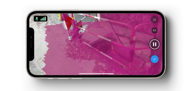
Pix4D Launches New Ground Image Capture App for 3D Modeling With the iPad Pro and iPhone 12 Pro
Pix4D, the photogrammetry industry leader, announces today the release of a new app product for ground images acquisition: Pix4Dcatch. Pix4Dcatch empowers users to easily create ground-based 3D models using an

Bentley Systems Commits $100 Million of Venture Funding to Accelerate Infrastructure Digital Twins
Launches Bentley iTwin Ventures to co-invest in digital twin ecosystem Bentley Systems, Incorporated (Nasdaq: BSY), the infrastructure engineering software company, today announced the establishment of Bentley iTwin Ventures to invest in promising technology companies addressing the

ISRO Launches EOS-01 and Nine Other Satellites
EOS-01 is an earth observation satellite intended for applications in agriculture, forestry and disaster management support.
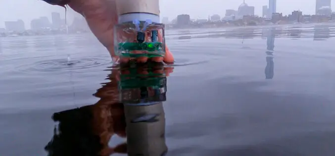
MIT Develop Battery Free Underwater Navigation System
MIT researchers have built a battery-free underwater navigation system dubbed Underwater Backscatter Localization (UBL).The system does not emit its own acoustic signals rather UBL reflects modulated signals from its environment.
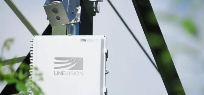
LiDAR Sensor to Protect Vital Electrical Utilities
Velodyne and LineVision have signed an agreement to provide sensors to protect electric utilities and help to improve electric utility operations.
USGIF Accepting Applications for Annual Scholarship Opportunities
The United States Geospatial Intelligence Foundation (USGIF) announces the opening of its 2021 Scholarship Program. Every year, USGIF awards scholarships of various amounts to exceptional students studying GEOINT, geospatial sciences,
