
Tag "topography"
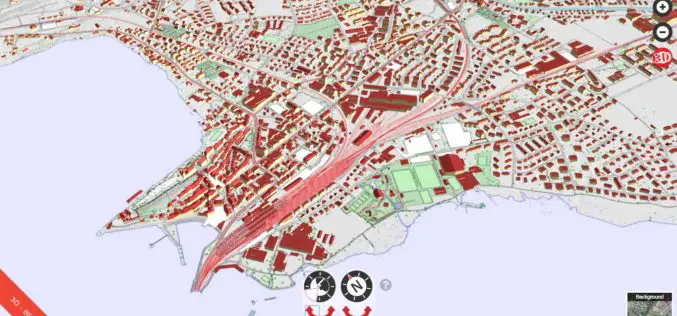
Cesium’s 3D Tiles Selected for Swiss Geospatial Portal
Swiss government agency adopts Cesium & its 3D Tiles format to offer extensive national geodata collection via BETA Version of an online interactive portal. PRWeb – Switzerland’s national mapping agency,

Introducing TerraSmart’s New Fleet of High Precision Aerial Site Mapping Drones
High-Precision Aerial Site Mapping Drones Streamlines Site Topography for Faster and More Profitable Solar TerraSmart proves once more that autonomous technology brings increased precision, speed and cost-savings to the
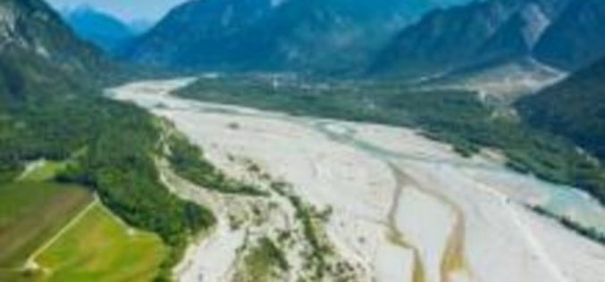
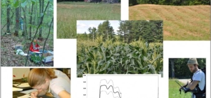
A New Method for Mapping River Properties Using Remote Sensing
A JRC-led article published in Remote Sensing last week presents a new method for mapping river properties using remote sensing. The new method provides a tool for monitoring and characterising the
Contour Mapping for Flood Free Mumbai
According to recent news by the Hindustan Times, Maharastra Chief Minister Devendra Fadnavis has informed in State Assembly that contour mapping will be made mandatory for builders who seek permission
OpenTopography Releases Raster Datasets for California, Colorado, New Hampshire and Washington
Recently OpenTopography has to announce the release of seven new raster datasets. These datasets are available for areas in California, Colorado, New Hampshire and Washington. All datasets were collected between 2010 and 2012.
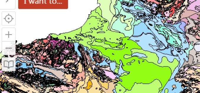
WA Geology – A Geology Mapping App for Mobile Devices
The Government of Western Australia has launched a mobile app for geology mapping. The mobile app WA Geology – is a web-mapping application that requires use of a wide variety
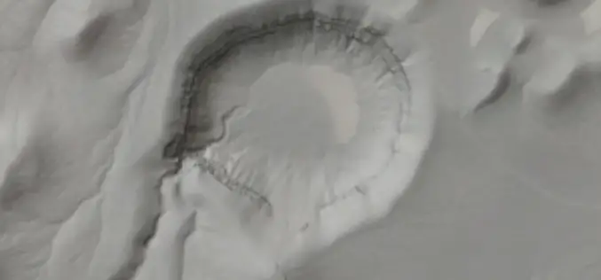
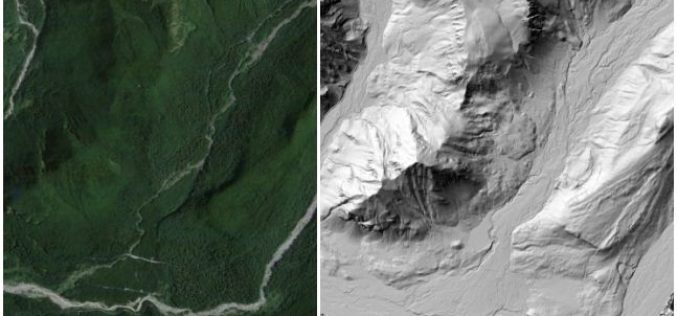
Airborne LiDAR Datasets Covering Two Volcanic Fields and a River Confluence
OpenTopography is pleased to announce the release of three new LiDAR datasets covering two volcanic fields in Northern Arizona and Nevada as well as a river confluence in Colorado. The

Airborne LiDAR to Find Clues of Inhabitants in Amazon River Basin
In recent news by Archaeology, European Research Council has funded an international project to search the Amazon River Basin for clues to the forest’s inhabitants for the past 3,000 years.
ESA’s Earth Explorer Mission to Study Vegetation Biomass
Following the initial selection in 2013 for Biomass to become ESA’s seventh Earth Explorer mission and the completion of preparatory activities, ESA Member States yesterday gave the green light for

Land Applications of Radar Remote Sensing
The aim of this book is to demonstrate the use of SAR data in three application domains, i.e. land cover (Part II), topography (Part III), and land motion (Part IV).
