
Posts From GIS Resources

Uzma Berhad Launches Malaysia’s First High-Resolution Earth Observation Satellite – UZMA SAT-1
Uzma Berhad, a prominent Malaysian oil and gas services provider, has successfully ventured into space technology with the launch of its first Earth observation satellite, UZMA SAT-1. This milestone was

TatukGIS SDK for Python is Free
TatukGIS announces the availability of its GIS library designed for the Python programming language (DK for Python) as a free product, even for commercial use, with the restriction that any

UNL and USDA Collaborate on a Web-Based Soil Sampling Tool
A collaborative effort between the University of Nebraska–Lincoln (UNL) and the U.S. Department of Agriculture (USDA) has led to the development of the Soil Sample Planning Organizer Tool (SSPOT), a

Fugro Expands Seafloor Mapping Efforts for Florida’s Coast
Fugro is playing a bigger role in the Florida Seafloor Mapping Initiative (FSMI), led by the Florida Department of Environmental Protection (DEP). This long-term seafloor mapping project aims to map

Hyperspectral Plastic Detection for Riverine Cleanup
Plastic pollution in rivers is a growing environmental challenge. With millions of tons of plastic waste flowing into oceans annually, the need for effective monitoring and cleanup has never been
Hexagon to Acquire Septentrio, Revolutionising Positioning in Mission-Critical Navigation and Autonomy Applications
Hexagon has announced an agreement to acquire Septentrio NV, a leading OEM provider of Global Navigation Satellite System (GNSS) technologies, to drive innovation and expand the market reach of Resilient
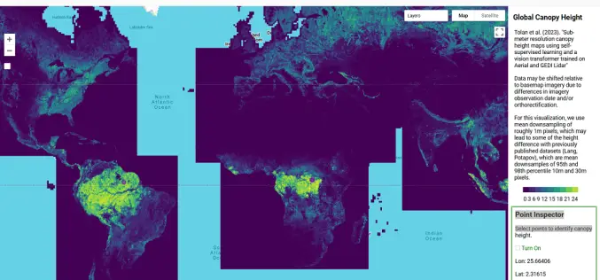
AI-Powered Tree Canopy Map by Meta and WRI
Meta, in collaboration with the World Resources Institute (WRI), has launched an advanced AI-powered Tree Canopy Map that provides unparalleled accuracy and detail in monitoring forests worldwide. By analyzing trillions
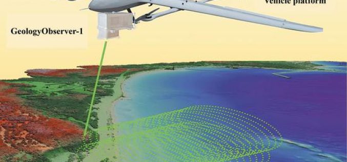
China’s GeologyObserver-1 Revolutionizes 3D Mapping
Chinese researchers have unveiled the GeologyObserver-1, a cutting-edge airborne device designed to create precise 3D surface models of both terrestrial and aquatic environments. This breakthrough is expected to transform environmental
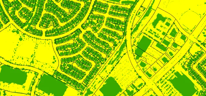
From imagery to impact: how high-resolution aerial data transformed water sustainability efforts in Southern California
Authored by- Hexagon In Southern California, water scarcity is a critical issue. Due to periodic droughts and the growing impacts of climate change, the region faces urgent challenges when it
Introducing Geospatial Cloud Serv: The Comprehensive Geospatial Data Management and Visualization Platform
Tech Maven Geospatial launches GeospatialCloudServ, a revolutionary geospatial data serving and content management platform that transforms how organizations collect, manage, analyze, and visualize spatial data across multiple platforms and devices
