
Posts From GIS Resources
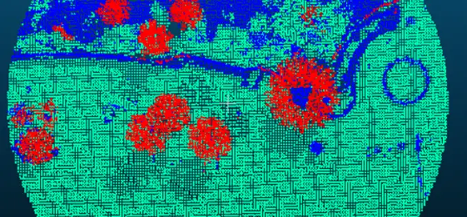
Forest Canopy LAI and Vertical FAVD Profile Inversion from Airborne Full Waveform LiDAR Data Based on a Radiative Transfer Model
Forest Canopy LAI and Vertical FAVD Profile Inversion from Airborne Full Waveform LiDAR Data Based on a Radiative Transfer Model – Han Ma, Jinling Song and Jindi Wang Abstract: Forest

RIEGL LIDAR 2015 User Conference: Hong Kong Opening with Impressing Keynotes and Significant RIEGL Product News
RIEGL LIDAR 2015 User Conference Hong Kong and Guangzhou: Hong Kong Opening with Impressing Keynotes and Significant RIEGL Product News RIEGL launched the first part of its ambitious LIDAR 2015 “One Conference, Two

Bramor gEO UAV from C-ASTRAL Reviewed by the Geo-Matching Community
The Geo-matching.com website features a selection of the most important geomatics equipment, including UAS for Mapping and 3D Modelling. At www.geo-matching.com, you can compare product specifications and read users’ reviews
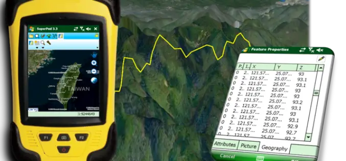
Perfection and Profession. Meet the Brand New SuperPad 3.3!
It is really our pleasure to share with you that the latest version of the SuperPad released for global users. Supergeo R&D team have been focusing on usability and reliability
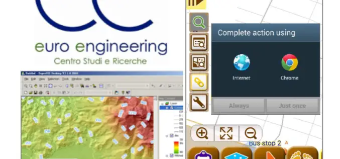
Euro Engineering, Italy Raises Research Value by Using SuperGIS
Supergeo, the leading GIS software and solution provider, announces that Centro Studi e Ricerche Euro Engineering – Soc. Coop. a r.l. (Euro Engineering) raises their research quality by using SuperGIS

ISRO Stresses on Research on Geospatial Technology
According to recent news by ToI, Indian Space Research Organization (ISRO) chairman A S Kiran Kumar stressed on the importance of cultivating a large student workforce for academic research especially

eXom Ready For Take-Off — sensefly’s Intelligent Mapping And Inspection Drone Now Available To Pre-Order
senseFly confirms release timings & technical specifications of its sensor-rich, multi-imaging rotary drone at Unmanned Systems 2015 (Hall B2, Booth 519) Unmanned Systems 2015, Atlanta, May 5, 2015 – Swiss

Trimble Partners with Industry Leading Multirotor Unmanned Aircraft System Manufacturer
New Geospatial and Agriculture Workflows and Deliverables through Additional Aerial Imaging Solutions ATLANTA, May 5, 2015—Trimble (NASDAQ: TRMB) announced today that it is partnering with leading unmanned aircraft system (UAS)
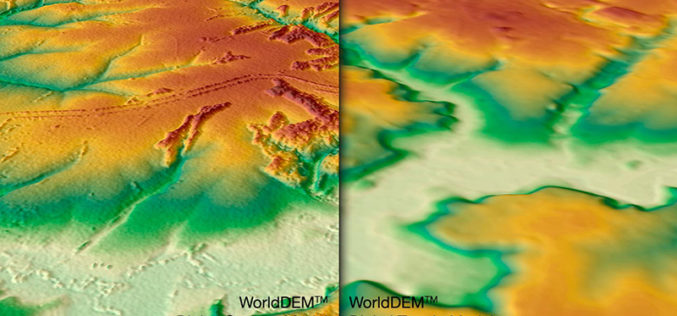
WorldDEM DTM Now Available
Precise Terrain Information Globally for Effective Analysis The WorldDEM Digital Terrain Model (DTM) is now commercially available for all users that need superior terrain information anywhere on the globe. The
International Training Course On “Ocean Colour Remote Sensing – Data, Processing and Applications” Organized by ITCOcean & ESSO-INCOIS
International Training Course On “Ocean Colour Remote Sensing – Data, Processing and Applications” Organized ITCOcean and ESSO-INCOIS, Hyderabad, India November 10-14, 2014 Indian National Center for Ocean Information Service (INCOIS) under Earth
