
According to recent news by ToI, Indian Space Research Organization (ISRO) chairman A S Kiran Kumar stressed on the importance of cultivating a large student workforce for academic research especially in the field of geospatial technology on Monday.
Recently, ISRO brought out structural analysis software called FEAST (Finite Element Analysis of Structures). The ISRO chairman said that institutions are allowed free download of the software and they are being asked to bring in case studies which can be incorporated in the software. He said, “There is a host of technologies in which we are trying to envisage use of academic institutions and students pursuing M Tech programs to participate in such activities”.
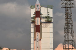
The chairman also spoke about 7 projects and launches planned under the ISRO until March 2016. This includes the launch of PSLV in June this year which will carry three disaster monitoring constellation satellites and the launch of GSAT 15 in October.
Speaking on the sidelines of Sathyabama University’s convocation, A S Kiran Kumar said, “There are tremendous opportunities available today and hands-on experience is vital for students”
He also spoke about the necessity of crowd sourcing. “Today a lot of softwares are developed abroad and purchased by institutions at a high cost.So, ISRO is trying to bring in a process where academic institutions start working on such software technologies themselves”.
“The Director General of Civil Aviation had recently announced services of APV (Approach procedure with vertical guidance) for precision approach for vertical landing. This will make sure that India is the 3rd country to avail such services, enabling the aircrafts to come close to the landing point,” he said.
For more information, visit at: http://timesofindia.indiatimes.com/city/chennai/ISRO-stresses-on-research-on-geospatial-technology/articleshow/47076837.cms