
Posts From GIS Resources
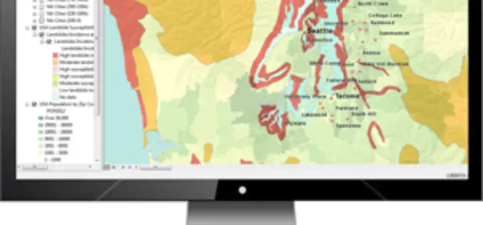
TerraGo Publisher Version 6.7 Delivers Free GIS-Lite Applications from ArcMap
TerraGo Publisher for ArcGIS is an extension to Esri ArcGIS that allows you to produce and exploit GeoPDF documents with ArcMap. You can define global defaults to be used when
FOSS4G Europe Conference – First Keynotes Speakers Announcements!
The second edition of the FOSS4G Europe Conference will be held at Politecnico di Milano in Como, Italy, from July 15th to 17th, 2015. A day of workshops will precede
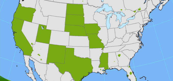
PR: Hexagon Imagery Programme Releases New Airborne Imagery Content
Imagery for a full 11 states plus portions of six other states in the U.S. have been provided in the HxIP as part of its airborne imagery offerings from the

Explore and Download Berlin 3D City Model
The 3D city model of Berlin the German capital is open to the public as Open Data. The Berlin 3D city model data plays a leading role throughout Europe in the
Oklahoma Forestry Services Using Wildfire App to Save Lives
Oklahoma Forestry Services is using wildfire app “Collector” in firefighting. Collector is a cutting-edge app to fight fire and save lives. Oklahoma is the first state in the United States of
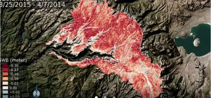
NASA: California Tuolumne Snowpack 40 Percent of Worst Year
New NASA data find the snowpack in the Tuolumne River Basin in California’s Sierra Nevada — a major source of water for millions of Californians — currently contains just 40
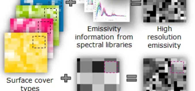
Urban Surface Temperature Time Series Estimation at the Local Scale by Spatial-Spectral Unmixing of Satellite Observations
Urban Surface Temperature Time Series Estimation at the Local Scale by Spatial-Spectral Unmixing of Satellite Observations – Zina Mitraka, Nektarios Chrysoulakis, Georgia Doxani, Fabio Del Frate and Michael Berger Abstract: The study of urban

Introduction to GIS for Agriculture: Rangeland Focus Workshop
Introduction to GIS for Agriculture: Rangeland Focus Workshop Wednesday, April 15th, 2015, from 8:00am to 1:00pm Informatics and GIS Program (IGIS) by University of California aims to support research technology
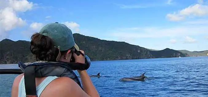
Spatial Mapping Reveals Importance of Hauraki Gulf Waters
The most extensive spatial mapping of the Hauraki Gulf waters has identified a new area of importance for nationally endangered bottlenose dolphins, as well as demonstrating how these waters are
Optech Presenting the Latest Mapping Solutions for Geosciences at EGU 2015
April 8, 2015 — Optech is pleased to announce that it will attend the 2015 European Geosciences Union (EGU) General Assembly in Vienna, Austria on April 12-17 to discuss the
