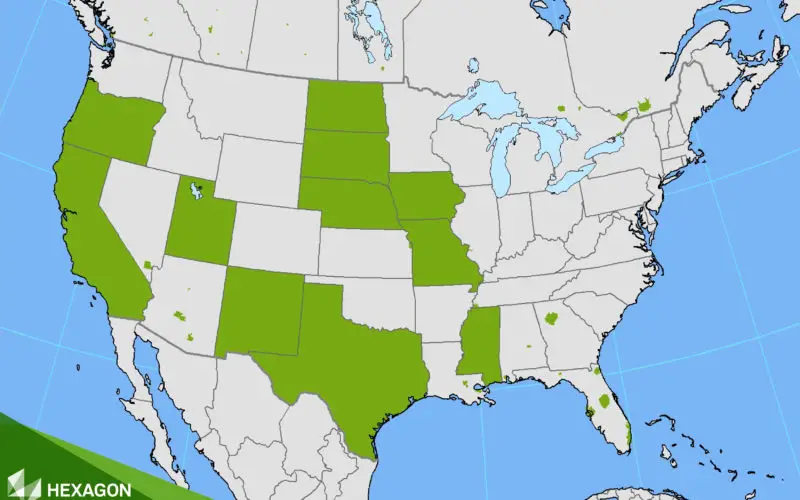
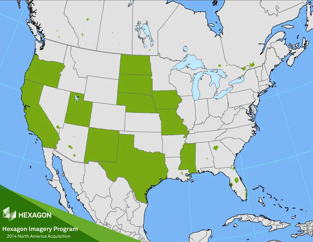
HxIP 2014 North America Acquisition
Imagery for a full 11 states plus portions of six other states in the U.S. have been provided in the HxIP as part of its airborne imagery offerings from the 2014 flying season. Portions of Canada and Europe are also available in the recent release.
“We’re pleased to have met our 2014 program goal, providing access to quality and consistent air-borne imagery for thousands of clients around the globe,” said John Welter, president of Leica Geosystems Geospatial Solutions Division and director of the HxIP. “We are well on our way of realising our 2015 goals with collection currently underway in Europe and North America.”
The HxIP airborne imagery content is available through the cloud via multiple content service provid-ers:
• Esri’s ArcGIS Marketplace
• Hexagon Geospatial’s Power Portfolio
• Valtus
Through the recent distribution partnership with Esri in February, the 2014 collection is now available to even more users on Esri’s ArcGIS Marketplace.
“Serving HxIP via Esri’s ArcGIS Marketplace gives geospatial professionals another choice in accessing the most current and accurate geospatial imagery available,” said Juergen Dold, president of Hexagon Geosystems. “The focus of our new partnership is to provide imagery in a simple and efficient way across a wide array of professional consumers.”
This vision was reinforced by Esri’s Director of Imagery, Lawrie Jordan: “Leica Geosystems is recognized globally as providing the highest quality and most accurate airborne imagery available, and Esri is delighted to offer this content to GIS professionals through our ArcGIS Marketplace.”
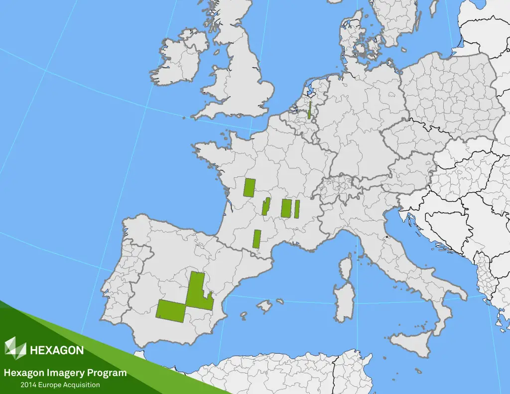
HxIP 2014 Europe Acquisition
Launched in June 2014, the HxIP streams valuable geospatial content and delivers professional-grade airborne images captured with Leica Geosystems’ airborne sensors, including enhanced-resolution, four-band orthos, streamable and rasterised point clouds, and stereo imagery, through two service categories:
• Basemap
Offers cached background maps of current 30 centimetre orthorectified imagery that will be updated on a regular basis.
• Multispectral Imagery
Supports image analysis and exploration activities with 30 centimetre, four band orthorectified imagery, and related digital surface models (DSM).
Hexagon Geosystems is the complete reality-capture solutions provider. With a sharp focus on in-formation technologies that capture, measure, and visualise data, our high-quality products and solutions create real digital worlds. With more than 4,500 employees in 33 countries operating technology and service centres on three continents with partners in 120 countries, we have the global reach to work with organisations through precise measuring instruments, engaging software, and trusted services.
Hexagon Geosystems is part of Hexagon, a leading global provider of information technologies that drive quality and productivity improvements across geospatial and industrial enterprise applications. Hexagon’s solutions integrate sensors, software, domain knowledge, and customer workflows into intelligent information ecosystems that deliver actionable information, automate business processes and improve productivity. They are used in a broad range of vital industries. Hexagon (Nasdaq Stockholm: HEXA B) has more than 15,000 employees in 46 countries and net sales of approximately 2.6bn EUR. Learn more at hexagon.com.