
Posts From GIS Resources

Iran to Launch 4 Satellites
In recent new, Iran is planning to launch four new satellites with domestically-designed carriers into the space in the near future. The four satellites are named as Sharif Sat, Zafar (Triumph), Tolou

Multi-Sensor Positioning Training for PhDs at University of Nottingham
The University of Nottingham is a public research university based in Nottingham, Nottinghamshire, England, United Kingdom. It was founded as University College Nottingham in 1881 and granted a Royal Charter
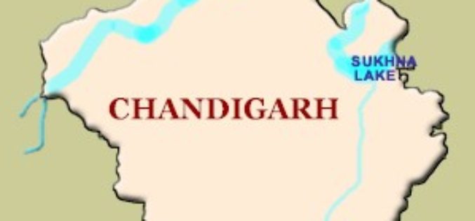
GPS to Map Accident-Prone Areas in Chandigarh
In recent news, Chandigarh traffic police has planned GPS mapping of the entire city. This maps will be created using Geographical Information System (GIS) and will be uploaded online and

Training – Satellite Observations and Products for Agro-meteorological Applications
Special Training Course on Satellite Observations and Products for Agro-meteorological Applications Organized by Indian Institute of Remote Sensing (IIRS), ISRO under the aegis of Indian Meteorological Society December 1–5, 2014 Indian

Acute3D’s Smart3D Capture to Document The Great Wall of China in 3D
The project of modeling the Great Wall of China in 3D was officially launched last September 16, 2014 under the supervision of China’s Ministry of Culture and State Administration of
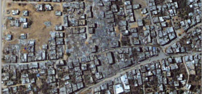
Impact of the 2014 Conflict in the Gaza Strip – UNOSAT Satellite Derived Geospatial Analysis
Impact of the 2014 Conflict in the Gaza Strip – UNOSAT Satellite Derived Geospatial Analysis This satellite derived geospatial analysis documents damages over the Gaza Strip following the July-August 2014

Free GIS Data – Transport and Communications Data
Free GIS Data – Transport and Communications Data Transport and Communications Data Open Flights: Airport, airline and route data across the globe. Data is provided as CSV files which

Free GIS Data – Buildings, Roads and Points of Interest Data
Free GIS Data – Buildings, Roads and Points of Interest Data Buildings, Roads and Points of Interest Data OpenStreetMap: Crowd-sourced data for the whole world consisting of most things

Free GIS Data – Population Data
Free GIS Data – Population Data Population Data Gridded Population of the World: Includes raw population, population density, both historic, current and predicted. Global Rural-Urban Mapping Project: Based on
Free GIS Data – Administrative Boundaries Data
Free GIS Data – Administrative Boundaries Data Administrative Boundaries Data Natural Earth: Includes countries, disputed areas, first-order admin (departments, states etc), populated places, urban polygons, parks and protected areas
