
Posts From GIS Resources

RFP: Award of Work for Carrying Out GIS LT Network Survey & Digitization in BRPL
BSES Rajdhani Power Limited, Delhi invites sealed tenders in 2 envelopes for “Award of Work for Carrying Out GIS LT Network Survey & Digitization in BRPL” NIT NO CMC/BR/13-14/ASG/VKS/330 Dt.

M.Tech in Geoinformatics by Indian Institute of Space Science and Technology
Admission Notification for M.Tech. in Geomatics for The Academic Year 2014-2015 Indian Institute of Space Science and Technology (IIST) has been established in the year 2007 as an autonomous academic institution
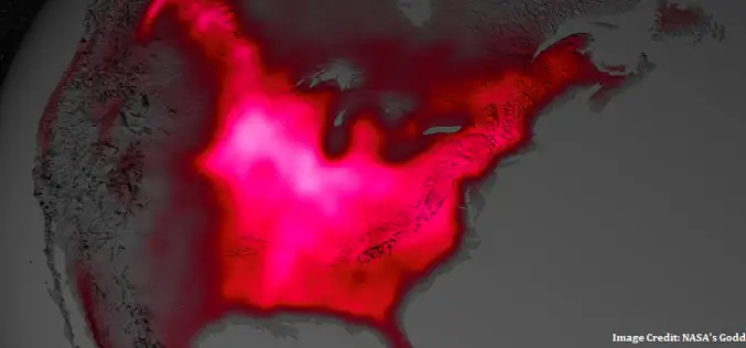
Satellite Shows High Productivity from U.S. Corn Belt
Data from satellite sensors show that during the Northern Hemisphere’s growing season, the Midwest region of the United States boasts more photosynthetic activity than any other spot on Earth, according
China Plans to Setup Constellation of Satellites to Monitor Entire World
In recent news, China is aggressively planning and considering the need of its network of surveillance and earth observation satellites to cover entire world. The move was reportedly inspired by
New Satellite Sensors in Wake of Missing MH 370
In recent news by Reuters, after mysterious missing of Malaysian flight MH 370 has driven the attention of researchers and industries to develop some satellite technologies that will make it easier

Information Boucher on Global Precipitation Measurement (GPM) Core Observatory
The Global Precipitation Measurement (GPM) mission is an international partnership co-led by NASA and the Japan Aerospace Exploration Agency (JAXA). The mission centers on the deployment of the GPM Core
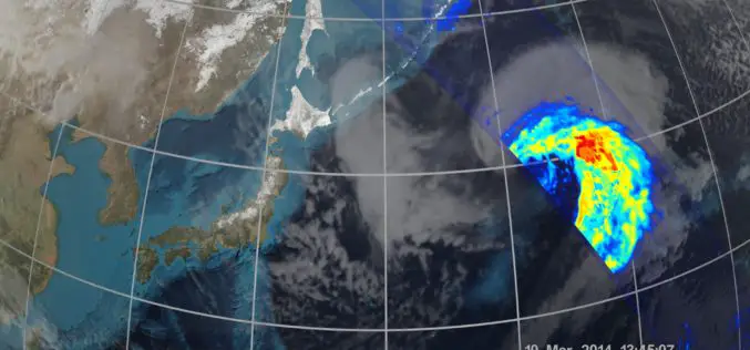
NASA | GPM’s Stormy New View
The GPM Core Observatory was the first of five planned Earth science launches for the agency in 2014. The joint NASA/JAXA mission will study rain and snow around the world,
First Images Available from NASA-JAXA Global Rain and Snowfall Satellite
NASA and the Japan Aerospace Exploration Agency (JAXA) have released the first images captured by their newest Earth-observing satellite, the Global Precipitation Measurement (GPM) Core Observatory, which launched into space
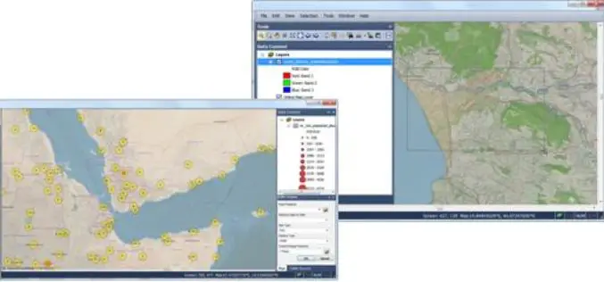
SuperGIS Engine 3.2 Globally Released for Efficient GIS Development
Supergeo Technologies, the leading global provider of complete GIS software and solutions, officially released SuperGIS Engine 3.2 to assists GIS developers in customizing GIS applications to meet diverse requirements of
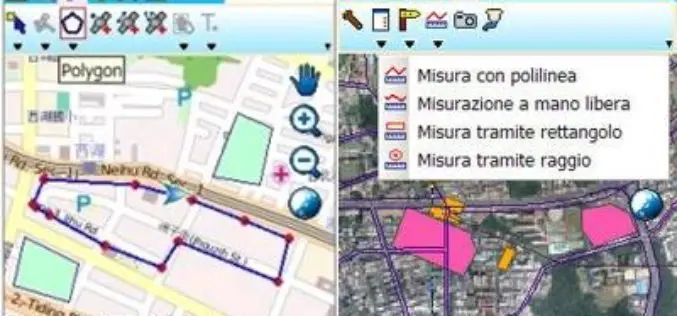
Plaza GPS, Indonesia, Selects SuperPad to Enhance Mobile GIS Provision
Supergeo Technologies, the leading global provider of complete GIS software and solutions, announced the cooperation with Plaza GPS, Indonesia. The experienced hardware provider selected SuperPad through PT. Datascrip, Supergeo’s partner,
