
Posts From GIS Resources
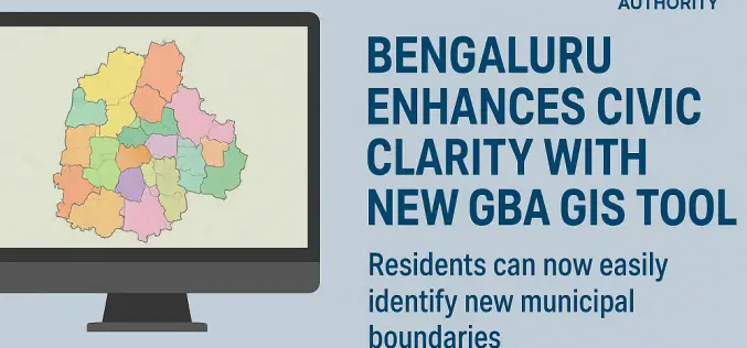
Bengaluru Enhances Civic Clarity with New GBA GIS Tool
In a significant stride toward improving urban governance, the Greater Bengaluru Authority (GBA) has unveiled a powerful GBA GIS tool to help residents easily identify the new municipal boundaries following
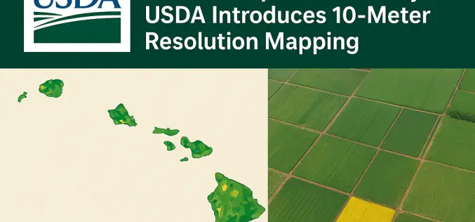
Hawaii Cropland Data Layer: USDA Introduces 10-Meter Resolution Mapping
The U.S. Department of Agriculture’s National Agricultural Statistics Service (NASS) has announced a significant update to its widely used Cropland Data Layer, enhancing it with 10-Meter Resolution. This development was
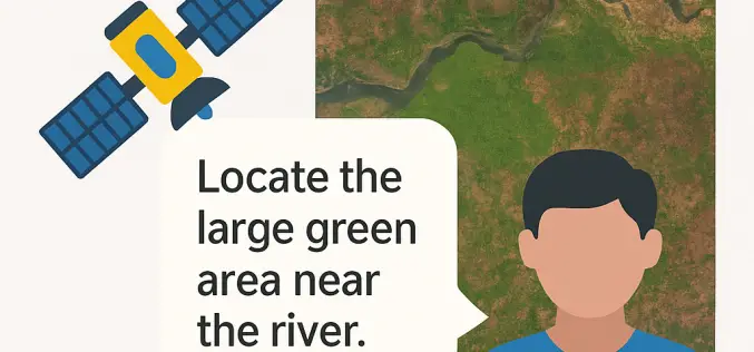
IIT Bombay Unveils AMVG Model That Reads Satellite Images with Natural-Language Prompts
In a breakthrough for remote sensing technology, the Indian Institute of Technology Bombay (IIT Bombay) has developed the Adaptive Modality-guided Visual Grounding (AMVG) model, capable of interpreting satellite and aerial

Hyderabad CM Orders LiDAR Survey to Prevent Encroachments on Water Bodies
Hyderabad Chief Minister A. Revanth Reddy has instructed officials to conduct an extensive LiDAR survey of lakes, nalas (drains), and other water bodies to curb illegal encroachments. The advanced remote-sensing
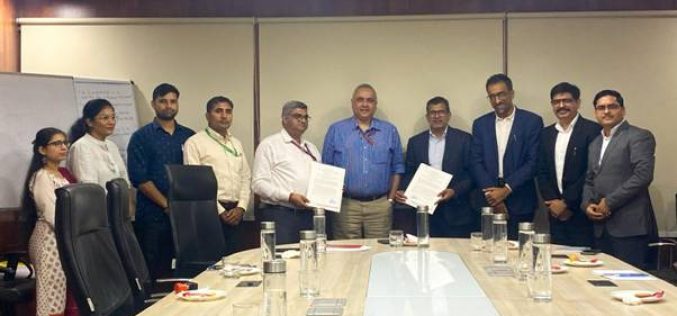
Department of Posts Strengthens DIGIPIN with ESRI India MoU
In a strategic move to bolster its digital capabilities, the Department of Posts (DoP) signed a Memorandum of Understanding (MoU) with ESRI India on September 1, 2025, to enhance the

Scanning Hallstatt: RIEGL LiDAR Transforms Exploration of a World Heritage Landscape
A Multi-Scale Case Study Featuring Interactive Reports Now Available on the ESRI ArcGIS Map RIEGL is proud to present a groundbreaking LiDAR case study in Hallstatt, Austria, a UNESCO World

Trimble Tackles GNSS Spoofing with First Multi-Constellation Anti-Spoofing Tech
GNSS spoofing has become a regular occurrence with the potential for severe consequences when precise and reliable positioning is critical. Legacy GNSS signals are the primary target for bad actors,

The Metop Second Generation A1 Satellite has been Successfully Launched from Europe’s Spaceport in Kourou
With a global audience watching in anticipation at launch events and online, Metop Second Generation A1 (Metop-SGA1) – also carrying the European Union’s Copernicus Sentinel-5 mission – lifted off on an Ariane-62
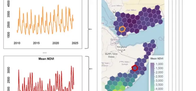
Transforming Remote Sensing Data with geeLite in R
A new R package called geeLite is helping bridge the gap between massive satellite datasets and local-level decision-making. Developed through a collaboration between the World Bank and University College London,

HERE and Genesys Join Forces to Tackle Distracted Driving in India
In a bold move to combat distracted driving and enhance in‑car safety, HERE Technologies and Genesys International have launched a strategic collaboration aimed at delivering next‑generation navigation systems tailored for
