
GIS
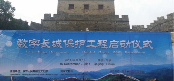
Acute3D’s Smart3D Capture to Document The Great Wall of China in 3D
The project of modeling the Great Wall of China in 3D was officially launched last September 16, 2014 under the supervision of China’s Ministry of Culture and State Administration of

Esri Brings Analytics to Urban Modeling for Smarter City Planning
Redlands, California—This provides urban planners, designers, and citizens easy to understand intelligence for improving their cities. ArcGIS provides deep insight into an urban scenario while CityEngine creates realistic digital 3D
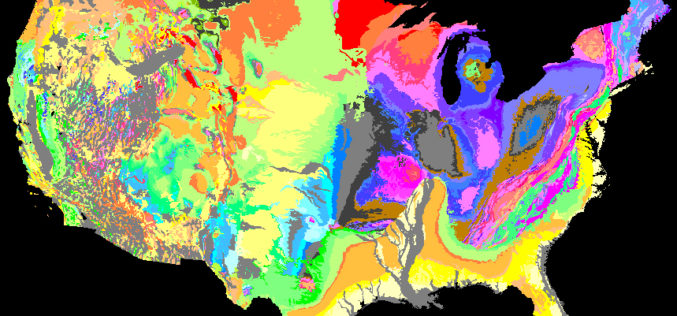
We Will Rock You – Geologic Map Day
The U.S. Geological Survey is partnering with the American Geosciences Institute, the Association of American State Geologists and others to promote the importance of geologic mapping to society. Celebrate the
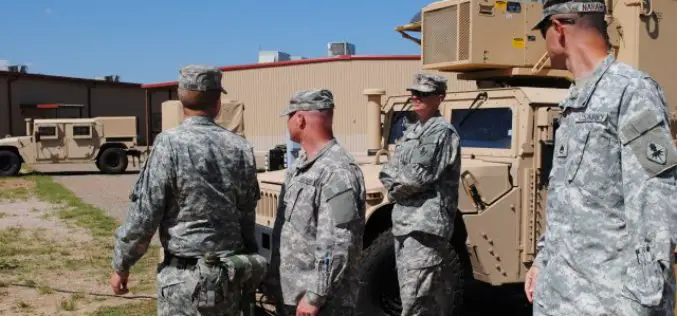
US Army Boosts Terrain Awareness with New Geospatial Analysis Tool
The US Army has developed a new geospatial analysis tool to help combatant commanders better plan their routes in unfamiliar locations. Developed by the US Army Engineer Research and Development

GIS Mapping of Chennai Corporation Wards
In recent news, first time Chennai Corporation is going to digitally maps its ward boundaries , streets and utilities in eight wards. The wards which will be digitally mapped using

GIS to Check Irregularities in Property Tax
In recent news, Andhra Pradesh, Ongole Municipality Corporation is planning to use Geographical information System (GIS) to check irregularities in property tax system. Ongole Municipality Corporation has engaged a consultancy, which
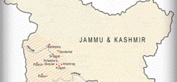
Google Crisis Tool for the Jammu and Kashmir Floods
In recent blog by Google India, Google has come up with a crisis tool to support the people who are affected by recent Jammu & Kashmir flood. The blog says:
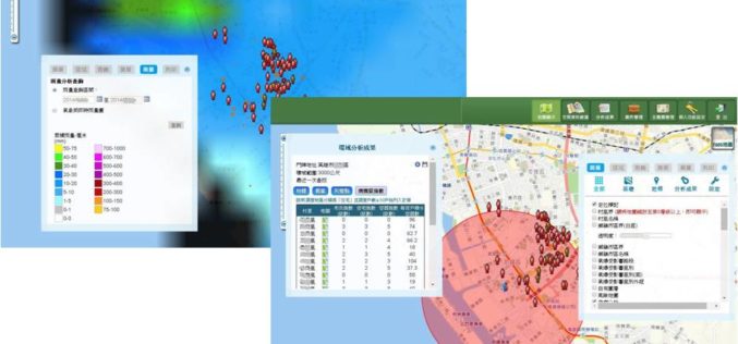
GIS-powered Vector Mosquito Data Management System to Enhance Public Health
In warm and humid subtropical areas like Southeast Asia, prevention and cure of vector mosquito is a key mission for epidemic and diseases control authorities. To achieve the goal, officers

Ways to Maximise the benefits of Abu Dhabi Spatial Data Infrastructure (AD-SDI) discussed during GIS Forum MENA
The Abu Dhabi Spatial Data Infrastructure (AD-SDI), a programme managed within the Abu Dhabi Systems and Information Centre (ADSIC), showcased its latest achievements and promoted discussions on the sharing of

An Exciting Challenge to Climb the Height of Everest Without Ever Leaving London – Step Up Mountain Challenge
The Mayor of London and Ordnance Survey support Daniel Raven-Ellison’s Step Up Mountain Challenge 8–17 September Daniel, from Ealing, has been dubbed the “guerrilla geographer” and his journey up the most famous,
