
GIS
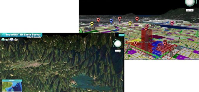
Smart City Solutions on 3D GIS Platform
Supergeo Technologies is going to bring GIS users a no-cost 3D GIS webinar to solve modern city management problems. The webinar will show how 3D GIS can be applied to

M Venkaiah Naidu Instructs DDA to Map Land in 3 Months
In recent news, Urban Development Minister M Venkaiah Naidu has instructed Delhi Development Authority (DDA) and all municipal bodies of Delhi to complete the mapping of all land properties using Geographical Information

Mapping Outbreak of Ebola: A Deadly Virus
The outbreak of Ebola in Western Africa has stuck fear in the heart of everyone about the visitors to the region or visitors from the region. The disease has a

UN Committee of Experts on Global Geospatial Information Management
The Committee of Experts on Global Geospatial Information Management calls for the adoption of common standards so that geospatial data can be seamlessly shared and used around the world The

BMC Plans to do Utility Mapping to Curb Road Digging
In recent news, the Brihanmumbai Municipal Corporation (BMC) is planning to use Geographical Information System (GIS) for maaping public utilities such as sewer and water lines. The use of GIS will

Utah Firm Provides Geospatial Technology to Map Ebola Victims, Outbreaks, and Clinic Locations in Liberia
Addressing Homes LLC is Bringing the Right Technology at the Right Time to Support West African Countries and the World Health Organization (WHO) SALT LAKE CITY, Aug. 11, 2014 – A U.S.

Chinese Democracy Supported by Geospatial Technologies
Since the 1997 Handover from United Kingdom to China, Hong Kong 1 July March has been the largest civil movement in HK. As the activity became more like a protest,

OGC Publishes Tested 10 Open Mobility Location Standards Engineering Reports
19 public Engineering Reports resulted from the Open Geospatial Consortium’s (OGC®) OGC Testbed 10, the most recent in the OGC’s yearly series of major geospatial interoperability testbeds. Six of these reports

Google Polluted Internet With Classified Material: Survey of India
NEW DELHI: After registering a Preliminary Enquiry against Google for alleged mapping of classified areas, the CBI has sought help of the Survey of India (SoI) which has alleged that
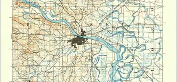
Revised Arkansas and South Carolina Maps Feature New Design
Newly designed US Topo maps covering Arkansas and South Carolina are now available online for free download US Topo maps now have a crisper, cleaner design – enhancing readability of maps
