
GIS

Boundless Introduces New QGIS Support Packages at FOSS4G
Benjamin Trigona-Harany to Conduct QGIS for Analysts Workshop at the Conference September 8, 2014 – Boundless, the leading provider of Spatial IT software and services, announced new QGIS support and training offerings
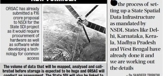
ORSAC to Frame Policy for Common Pool of Geo-spatial Info
In recent news, The Odisha Government has decided to frame out Data Sharing Policy agencies to bring all geo-spatial information generated by Odisha Space Application Centre (ORSAC) and State-run geospatial

Trimble Puts More Spatial Data in the Hands of Geospatial Professionals with its New InSphere Data Marketplace
Additional Enhancements to InSphere Applications Streamline Geospatial Data Access SUNNYVALE, Calif., Sept. 3, 2014—Trimble (NASDAQ: TRMB) announced today a new Data Marketplace service for the Trimble® InSphere™ geospatial information management

Deputy Prime Minister Announces Plans for a New Map of Accessible Green Space for England and Wales
03 Sep 2014 – The Deputy Prime Minister, Nick Clegg, today announced that Ordnance Survey would compile and release data to allow for a new map of every publicly accessible green

SuperGIS Assists South Africa in Economy Planning and Development
Supergeo Technologies, the global leading GIS software and solution provider, announces that Mangaung Metro Municipality (MMM), South Africa, utilizes SuperGIS Desktop and SuperSurv to evolve the city economic development. The

Gogoi Calls for Proper Mapping of Human Trafficking Areas
Assam Chief Minister Tarun Gogoi on Monday called for proper mapping of areas from where incidents of trafficking of children and women are reported. Gogoi, who chaired a review meeting
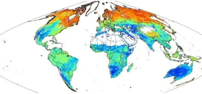
SoilGrids1km — Global Soil Information Based on Automated Mapping
SoilGrids1km — Global Soil Information Based on Automated Mapping By- Tomislav Hengl, Jorge Mendes de Jesus, Robert A. MacMillan, Niels H. Batjes, Gerard B. M. Heuvelink, Eloi Ribeiro, Alessandro Samuel-Rosa, Bas
SuperGIS Desktop Assists SME in USA in Conducting Restoration Projects
Supergeo Technologies, the global leading GIS software and solution provider, announces that SuperGIS Desktop 3.2 supports Bitterroot Technical Associates, USA, to guide restoration programs for environmental management. SuperGIS Desktop 3.2

OGC announces new Urban Planning Domain Working Group
20 August 2014. An OGC Urban Planning Domain Working Group (SWG) has been chartered to define the role for OGC standards and related activities within the Urban Planning discipline and

Web Application Optimized For Collaboration & Visualization of ESRI Map & Feature Services, KML & OGC
PASADENA, Calif., August 19, 2014 – TouchShare, Inc., the leader in next-generation geospatial collaboration solutions, is proud to announce the release of TouchShare Web, TouchShare’s browser application that leverages GIS investments
