
GIS
Geotagging to Avoid False Damage Claims
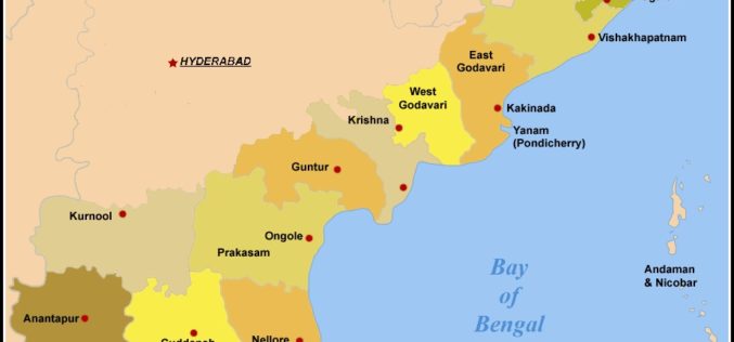
In recent news by The Indian Express, in his visit to Visakhapatnam post-Hudhud, Prime Minister Narendra Modi had suggested that the Andhra Pradesh State government use the latest technology to
Telangana Goes for Satellite Mapping
According to recent news, the Telangana state government has started project to map state-owned land through satellite imageries. Tamil Nadu based Info Maps as has already began work on some

Bhutan to Launch National Geospatial Portal
The National Geospatial Portal of Bhutan will be launched during the Bhutan GIS Expo on 13 October 2014, in Thimphu. The event is jointly organized by the National Land Commission
One Stop Shop for Renewable Energy Mapping Data for Australia
The Australian Renewable Energy Agency (ARENA) today announced up to $2.1 million funding for National ICT Australia (NICTA) to develop an online national renewable energy mapping platform. ARENA CEO Ivor
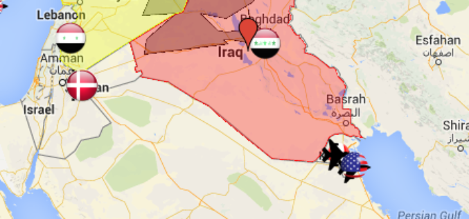
Mapping Air Strike and Air Base locations for the U.S.-led airstrikes on ISIS
According to The Guardian, September 29, 2014, US-led forces launched air strike overnight on territory controlled by Islamic State in Iraq and Syria (ISIS) in northern and eastern Syria while

INCOIS: 3D Mapping of Cyclone Prone Zones
Indian national Centre for Ocean Information Services (INCOIS) has started survey of cyclone prone areas. The survey carried out to build a comprehensive database of all residential and other construction
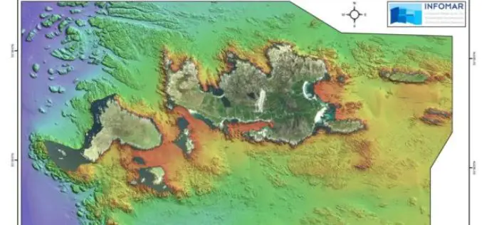
Geological Survey of Ireland Launches ‘Real Map’ of Inishbofin
Marine scientists from the Geological Survey of Ireland (GSI) have created a new offshore map of the island of Inishbofin, County Galway, which will be launched today (11th October 2014)

SuperSurv Elevates Tequila Industry Development in Mexico
Supergeo Technologies, the global leading GIS software and solution provider, announce that Consejo Regulardor del Tequila (CRT), A. C., Mexico, utilizes SuperSurv to strengthen blue agave management and tequila quality.

Peoples Natural Gas Standardizing Technologies with Esri
Eastern US Utility Streamlines Service with Geospatial Software Redlands, California—Peoples Natural Gas (PNG) is taking steps to further streamline utility service to 700,000 homes and businesses in Pennsylvania, West Virginia,
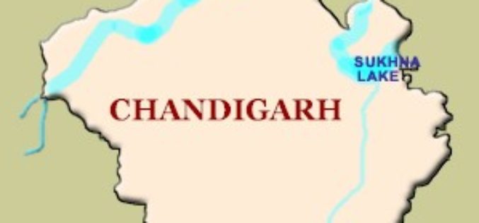
GPS to Map Accident-Prone Areas in Chandigarh
In recent news, Chandigarh traffic police has planned GPS mapping of the entire city. This maps will be created using Geographical Information System (GIS) and will be uploaded online and
