
GIS

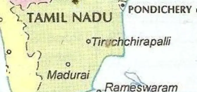
Institute of Forest Genetics and Tree Breeding to Map Trees in Tamil Nadu using GIS
In recent news, the Institute of Forest Genetics and Tree Breeding (IFGTB) is going to do Geographical Information System (GIS) based mapping of tress in all 32 districts of Tamil

Philippine National Irrigation Systems Upgrades Parcel Maps by SuperGIS Desktop
Supergeo Technologies, a leading global provider of GIS software and solutions, announces that Philippines National Irrigation Systems (NIA) upgrades the country’s parcellary maps through SuperGIS Desktop to elevate the efficiency
SuperGIS Spatial Statistical Analyst 3.2 Released Globally
Supergeo Technologies, a leading global provider of GIS software and solutions, officially launches SuperGIS Spatial Statistical Analyst 3.2 with powerful functions and optimization of interface for worldwide users. SuperGIS Spatial

Ordnance Survey: New off-Road Cycle Trail Maps Launched in Hampshire
Ordnance Survey has identified Hampshire as one of the nation’s main cycling hubs and has developed a set of mapping packs containing a range of off-road routes, enabling cyclists to explore
Tamil Nadu Integrates GIS Mapping to Check on School Dropouts
Tamil Nadu would be the first state in the country to integrate Geographical Information System (GIS) mapping with the education management information system to check on school drop outs, IT

Meghalaya Preparing Wind Energy Density Maps
Power-starved Meghalaya is preparing “wind energy density maps” to identify regions in the mountainous state where wind energy could be tapped to meet the power requirement, an official said Thursday.
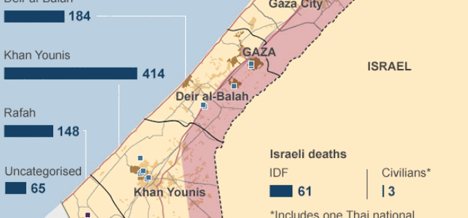
Mapping the Human Cost in Gaza
In recent news by BBC, more than 1,400 Palestinians have been killed and 450,000 have been forced to leave their homes since Israel launched Operation Protective Edge in Gaza on

West Bengal to Use GIS: Keep Track of Rural Development
In recent new, The West Bengal state government planning to setup a new geographic information system (GIS) technology based computer based system to keep track of progress of rural activities in

Maps.com Launches “Field Trip Library” for K–12 Students
Interactive Exercises Based on the Esri Story Map Platform Redlands, California— (GIS) concepts while exploring global culture, regional patterns, and major historical events through interactive maps. Field trips are enhanced with
GFK’S New Digital Maps of China Point The Way To Regional Turnover Potential
Bruchsal, Germany, July 31, 2014. – GfK has expanded and updated its digital maps for China. This includes an unprecedented six-digit postcode map for China’s ten largest cities. GfK’s detailed
