
GIS

Digimap for Schools Launches Historic Maps of Great Britain
Digimap for Schools has added a new historic map layer to the popular online map service, extending its potential for use in schools across a wider spectrum of the national

KSBB to verify ESA Mapping
In recent news, the Kerala State Biodiversity Board (KSBB) has been assign to do ground truth verification of map for 123 villages identified as ecologically sensitive areas (ESAs). The maps are
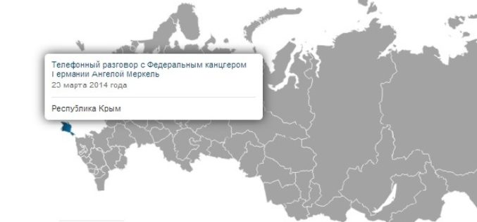
Google Mapmakers to Mark Crimea as Russian Territory
MOSCOW, April 11. /ITAR-TASS/. Google Russian-language mapmakers have marked Crimea as part of Russia. The world’s largest search engine has updated its mapping services maps.google.ru and maps.google.com, drawing a new state line between Crimea

Taipei City Government Launched a Online Historical 3D Map
In recent news by Liberty Times, The Department of Urban Development of Taipei City Government has launched a web based historical 3D map. The application facilitates citizens to compare the
Esri Geospatial Technology Speeds Analysis for US Army
Ready-to-Use Templates Quickly Deliver Critical Information to the Field April 7, 2014-Redlands, California—Esri has provided a recently revised set of customized templates to the US Army for its Distributed Common Ground

Comsoft Paris Uses SuperSurv 3 to Extend Enterprise Solutions
Supergeo Technologies, the leading global provider of complete GIS software and solutions, announced that Comsoft Paris selected SuperSurv, the data collection app for Android and iOS platforms, to extend business
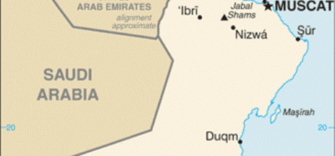
New GIS Smartphone App Launched by NCSI at COMEX 2014
Muscat | 6 April, 2014 – The COMEX 2014 exhibition, which opened its doors at Oman International Exhibition Centre on April 7, features a comprehensive presence from The National Centre for
Understanding Shapefile (.shp) File Format
Shapefile is a vector data format for storing geographical data and associated attribute information. It is developed and regulated by Esri as open specification for data interoperability among Esri and other GIS software products. Shapefile

UNDP to Support Saudi in Geospatial Capacity Building
In recent news, the UN Development Program (UNDP) have signed a capacity development project with the General Commission for Survey (GCS) with the main objective of developing national capacities in
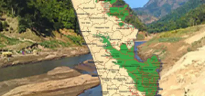
Callous Approach of KSREC in Mapping Ecologically Sensitive Areas
In recent news, the maps prepared by the Kerala State Remote Sensing and Environment Centre (KSREC) of Ecologically Sensitive Areas (ESAs) in the state, have major discrepancies including showcasing of
