
GIS

OGC Announces New Discrete Global Grid Systems Standards Working Group
The Open Geospatial Consortium (OGC®) announces the formation of a new OGC Technical Committee Standards Working Group (SWG). The purpose of this SWG will be to explore and propose terms

Indoor Google Maps for 75 Popular Indoor Venues
In a recent post in Google India blog, Indoor Google Maps comes up with 75 popular indoor venues across 22 cities in India. Google India has adopted My Location technology to
Qatar University Begins Digital Archiving
In a recent news by Gulf Times, Remote Sensing and Geographic Information Systems (GIS) Unit in the Environmental Studies Centre (ESC) at Qatar University has initiated the course of action to digitally
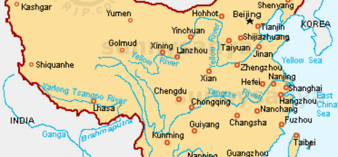
China Gathers Data of its 10, 500 Islands
In recent news, China has gathered detailed topographic topographic information and images of all its 10, 500 islands using remote sensing technology. It took three years of work by the aviation
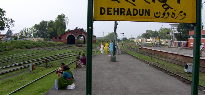
Dehradun Municipal Corporation Fails to Put GIS into Property Assesment
In a recent news by Hindustan Times, the Dehradun Municipal Corporation (DMC) has failed to put into use the Geographical Information System (GIS) for mapping properties in the state capital. In the

Google’s Project Tango
The goal of Project Tango is to give mobile devices a human-scale understanding of space and motion. Project Tango is the outcome of Google team working with universities, research labs,
Linking U.S. and Canadian Border Waters
In recent news by USGS, seamless digital maps of surface waters along the Canada and United States International Boundary are now possible. These maps make tracking complex water issues easier to solve

World Bank Credits $153 Million to Odisha Disaster Recovery Project
In a recent news, World Bank has approves a $153 million to the state of Odisha in India to strength its capacity for disaster risk management and to build disaster

As of No GIS Road Information for Nagaland
In recent news, there is no proper mapping or network database of roads for the entire state of Nagaland. It may be that entire world is enjoying the extensive road
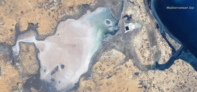
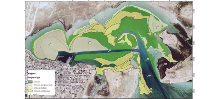
Remote Sensing and GIS to Study Geomorphology of Al Batinah
In recent news, researchers are using GIS and remote sensing technology to examine the Sabkhas and tidal inlets in Al Batinah plain. Sabkha is a transliteration of the Arabic word for a salt flat. Sabkhas are supratidal,
