
GIS
Issues to be Addressed While Georeferencing
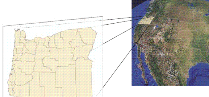
I already have discussed about Georeferencing in my previous post on August 28, 2013. Today I am adding few more important issues that need to be considered while understanding Geo-referencing

Fundamentals of GIS
What is GIS ? GIS stands for Geographic Information System. Introduction This portion provides an overview of GIS. It examines what GIS is, what it can do and, in brief, how it

Agendra Kumar as President of Esri India
New Delhi: NIIT Technologies Ltd, a leading global IT solutions organization today announced the appointment of Mr. Agendra Kumar as the President of its joint venture subsidiary NIIT GIS Ltd
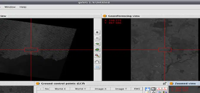
What is Georeferencing?
Today I was wondering while thinking about what I should post on GIS Resources. Then suddenly I got a click, why not about What is Georeferencing or what is georeferencing

Omantel Bags ‘Special Achievement’ Award From ESRI at GIS 2013
MUSCAT – Omantel has won a ‘Special Achievement’ in Geographic Information Systems (GIS) Awards 2013 from the Environmental Systems Research Institute (ESRI), which was organised in San Diego, California The award that
GIS to Map Forest Department’s Livelihood Programme
Jamshedpur, India: The forest department’s tribal empowerment livelihood programme will soon be controlled through geo satellite. The department has introduced a Geographical Information System (GIS) in the six forest divisions of Kolhan
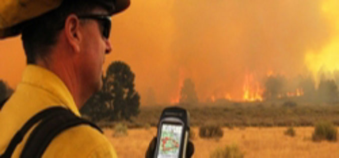
ISU, NASA Use New GIS-Satellite Imagery Program to Create Tool for Firefighters
POCATELLO – 35 minutes. That’s how long it took for the Idaho State University GIS Center to produce a detailed report that gave Bureau of Land Management wildfire managers information
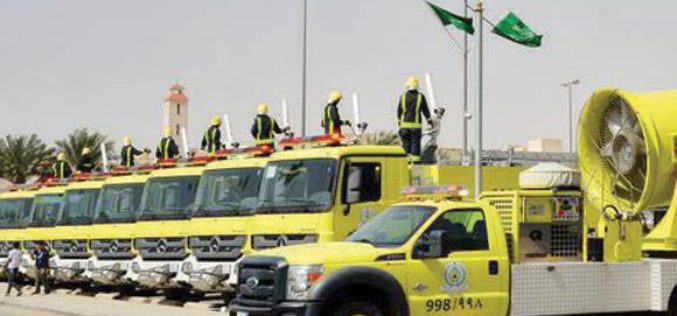
GIS to spur Civil Defense Response
The Civil Defense department will implement an electronic system that links its operations with houses for immediate response in events of fire. The system is already in application in Makkah and
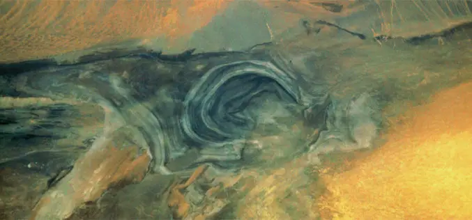
The Secrets of Lop Nor Lake
China’s “Great Ear” is the name for Lop Nor, located at the eastern end of the Tarim Basin. This name is clearly illustrated by the satellite image. The salt lake
The Breathing Earth
John Nelson has created “A Breathing Earth,” a series of animated GIFs made from NASA’s cloud-free satellite imagery of the Earth that show the oscillations of snow and greenery as the
