
GIS

Cabinet Apprised of ISRO-KISR MoU for Joint Space Exploration
New Delhi, Jan 20, 2016 – The Union Cabinet was today apprised of an agreement between ISRO and a Kuwaiti research body on cooperation in exploration of outer space and
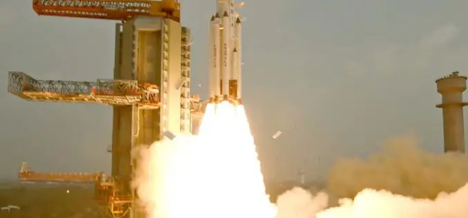
India Successfully Launches Fifth Navigation Satellite IRNSS-1E
ISRO’s Polar Satellite Launch Vehicle, PSLV-C31, successfully launched the 1425 kg IRNSS-1E, the fifth satellite in the Indian Regional Navigation Satellite System (IRNSS) on January 20, 2016, from Satish Dhawan
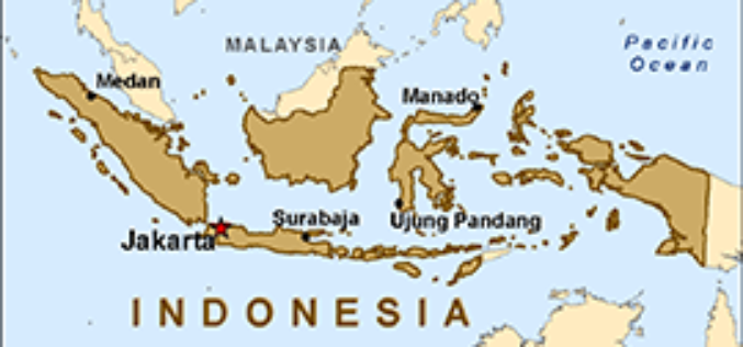
Indonesian Gears Up Smart City Roadmap with Smart Mapping Technology
The City of Depok, located in the West Java Province, Indonesia, has cemented its commitment to achieve smart city status by 2025 by leveraging state-of-the-art mapping technology to boost government
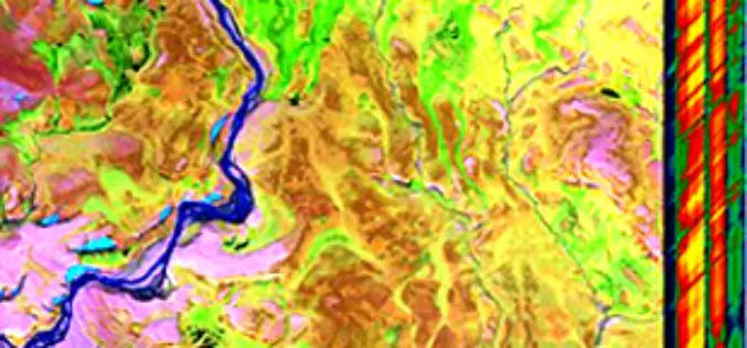
Global Hyperspectral Remote Sensing Market 2015 Industry Trends, Analysis and Forecast to 2019
Global Hyperspectral Remote Sensing Industry 2015 and analysis by 2019 analyzed the world’s main region market size, share,trends,conditions, including the product price, profit, capacity, production, capacity utilization, supply, demand and
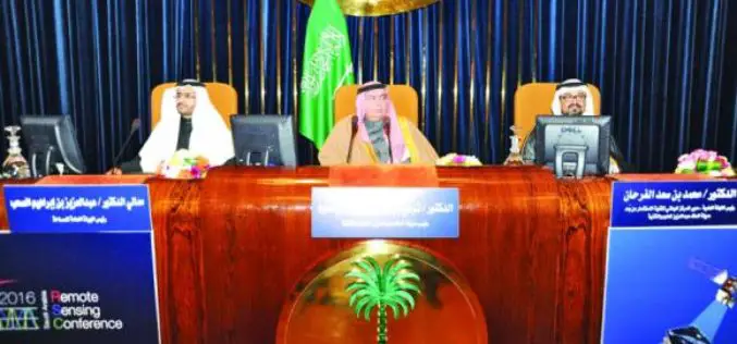
Saudi Arabia to Use ‘LIDAR’ for Satellite Imagery
Inaugurating the first International Remote Sensing Conference in Saudi Arabia at the King Faisal Hall on Sunday, the Prince Turki bin Saud bin Mohammed Al-Saud, Saudi Arabia said the King

NHAI Signs MoU with ISRO and NECTAR for Use of Spatial Technology for Monitoring and Managing National Highway
NHAI has signed Memorandum of Understanding with National Remote Sensing Centre (NRSC) under Indian Space Research Organization (ISRO) and North East Centre for Technology Application and Research (NECTAR) for use

Register Now for Esri UC 2016 and Receive $400 Off
ESRI UC 2016 – A Lot of Learning in One Location June 27-July 1, 2016 | San Diego, California Learn, network and share your experiences with 16,000 other Esri GIS
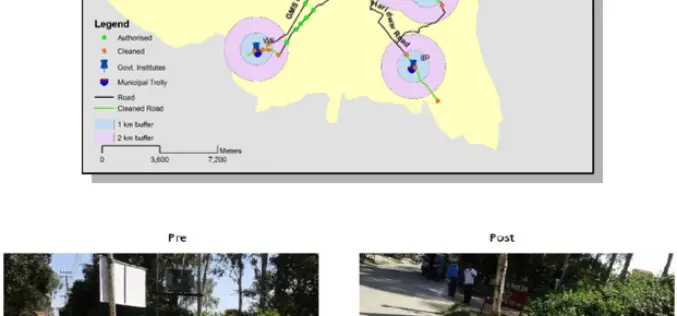
ISRO Utilizes Geospatial Technology for Swachh Bharat Abhiyaan
A novel initiative to contribute in the Swachh Bharat Abhiyaan using the Geospatial Technology (GST) was taken up jointly by the central Government institutions in Dehradun. This initiative was supported
World Bank Has Chosen UAV for Innovative Local Mapping
The World Bank is implementing a $12 million Real Estate and Cadastre Project to assist the government in producing a national cadastre system and geospatial data infrastructure. The team has

Japan Govt Eyes High-precision Hyperspectral Sensor to Detect Resources
The Government of Japan is planning to conduct a feasibility test for a high-precision sensor capable of detecting oil, rare earths and other mineral resources from the International Space Station
