
GIS

USGS Increases Public Access to Scientific Research
The U.S. Geological Survey is implementing new measures that will improve public access to USGS-funded science as detailed in its new public access plan. The plan enables the USGS to
Delhi Police to Use Space Tech for Crime Control
The Delhi Police will soon start using space technology for live crime mapping and adopting a “predictive policing” mechanism being developed in partnership with the Indian Space Research Organisation. “The

Mumbai Metropolitan Region Tied Up With the World Bank
Mumbai, India – According to recent news by The Indian Express, Mumbai city development authority has tied up with the World Bank to map the entire Mumbai Metropolitan Region (MMR),

ISRO Conducts 1st Satellite-based Warning system for Railways
According to recent news by The Indian Express, the first trial run for developing a satellite-based system to warn train drivers of unmanned railway crossings was conducted by ISRO scientists

Iran to Build Two Remote Sensing Satellites by 2025
Iran is planning to launch two national remote sensing and telecommunication satellites by 2025. Communications and Information Technology Minister Mahmoud Va’ezi said, “Indigenization of space technologies is the main focus
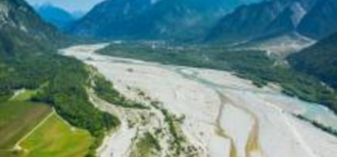
A New Method for Mapping River Properties Using Remote Sensing
A JRC-led article published in Remote Sensing last week presents a new method for mapping river properties using remote sensing. The new method provides a tool for monitoring and characterising the
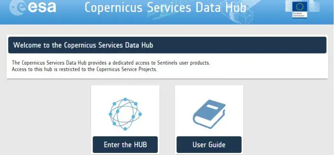
A New Sentinels Data Hub for the Copernicus Services
A new access point for the dissemination of the Sentinel products is in place for the Copernicus Service Project members: the Copernicus Services Data Hub. The Copernicus Services Data Hub initially
“Floodhack” Helps Mitigating Floods
On 16/17 January, the European Centre for Medium-Range Weather Forecasts (ECMWF) organized the first hackathon on a Global Flood Awareness System (GloFAS). More than 60 participants from research organizations, universities
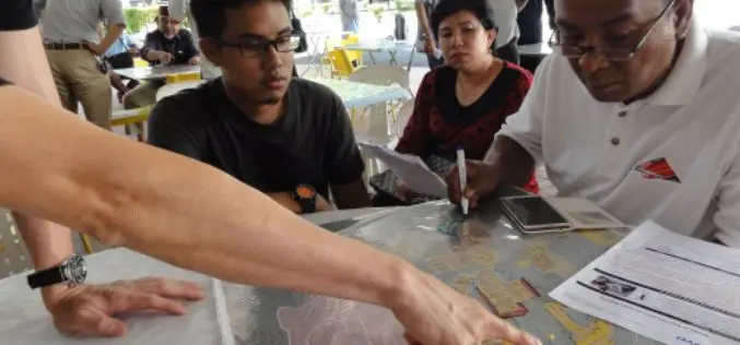
Community Mapping to Educate on Landslides
Kuala Lumpur – A local community-based organisation on landslides and slope safety, SlopeWatch embarked on a journey to educate hillside citizens on signs of slope failures to better equip them in
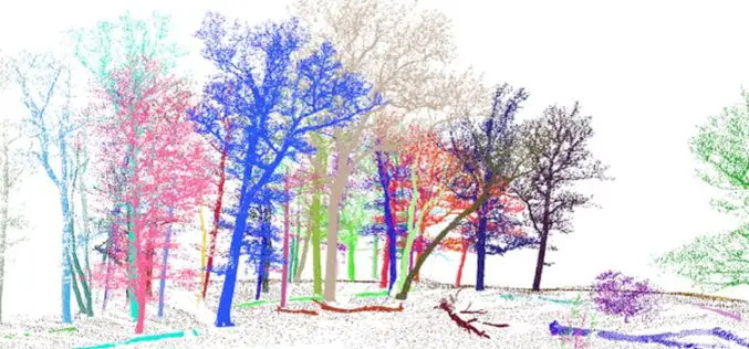
3D Forest – Forest LiDAR Data Processing Tool
Tool for point cloud data processing from forest environment acquired by terrestrial laser scanner (TLS) 3D Forest is an open-source software application for LiDAR data segmentation, visualization, and export of
