
GIS

Flipkart to Buying Stake in MapmyIndia
According to recent news by Livemint, online marketplace Flipkart Ltd is in talks to invest in four firms including maps provider MapmyIndia, to improve its supply chain efficiency. The Bengaluru-based

Google Maps Now Available Offline in India
Almost a week after announcing it in the US, last week Google has brought its Google Maps offline service to India. Google’s offline map makes the popular navigation and mapping tool

Keep Up-to-Date with ArcGIS API 4.0 for JavaScript
ArcGIS API 4.0 for JavaScript — for building interactive, compelling web applications — is available in beta. We’re leveraging advances in browser technology and the power of the ArcGIS platform
Collect Points – Get The Patch
The USGS National Map Corps will award special edition patches for volunteers contributing 2,016 points between GIS Day 2015 and GIS Day 2016 Using crowdsourcing techniques, the USGS project known

Pacific Island Meet to Emphasis on Capacity Building of Geospatial Services
Nov 17, 2015 – In the second annual meeting of Pacific Island lands, survey, and geospatial experts, agreed to draft a regional strategy for building the capacity of geospatial services

SPAR 3D Expo & Conference: Call for Papers
Call for Papers: Abstract Submission Form Deadline: December 6, 2015 SPAR International is renamed SPAR 3D Expo & Conference to enhance appeal for asset owners seeking fundamentals about 3D technologies

EU-Funded Project Enhanced Space Cooperation Between EU and Ukraine
An EU-funded Twinning Project in space cooperation with Ukraine has succeeded in harmonizing Ukrainian legislation to EU standards and supporting Ukraine’s involvement in EU Space Programmes, particularly in Satellite Navigation
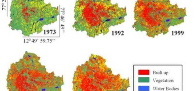
Study Reveal 125% Increase in Bengaluru Urban Growth
In a study by a group of scientists at Indian Institute of Science (IISc) has actually put a number changing land use and land cover in Bengaluru. Between 2000 and
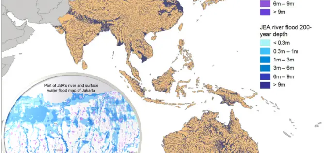
Asian Cities May See Increases in Flood Risk By 2020
Some rapidly growing Asian cities may see increases of up to 36% in the population at risk of extreme river and surface water flooding by 2020, according to recent study
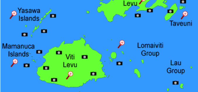
Fiji Government Assures its Commitment to Support Geospatial Industry
The Fijian Government has remained committed to the wide-spread use of geospatial technologies and to bringing Fiji’s existing technologies in line with international standards. Those were the sentiments of Prime
