
GIS

Supergeo Announces Partnership with T&B Radio Tech in Korea
Supergeo Technologies, the leading global provider of complete GIS software and solutions, authorized T&B Radio Tech, Republic of Korea, as a certified reseller to promote SuperGIS in information communication technology

Esri and E2open Partner to Deliver Market-Leading Supply Chain Solutions
Customers to Benefit from Rapid Demand-Supply Network Visualization on a Global Scale December 8, 2014 Redlands, California—E2open, the leading provider of cloud-based solutions for collaborative planning and execution across global trading
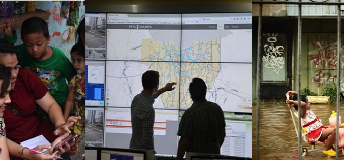
First-in-the-World: Indonesia is Using Tweets to Map Floods in Jakarta
Researchers have taken up the geospatial technology to a new horizon in Indonesia by using tweets from Twitter to map floods in Jakarta. Jakarta suffers from widespread annual flooding during

Enhanced Elevation Data for North and South America, Pacific Islands, Northern Europe
New Heights of Global Topographic Data Will Aid Climate Change Research The U.S. Geological Survey announced today that improved global topographic (elevation) data are now publicly available for North and

Autodesk Makes Design Software Free to Schools Worldwide
Design Software Leader Expands Reach of Free Education Offering to Prepare an Industry-ready Workforce Fulfilling its promise to expand access to its professional design software in education, Autodesk, Inc. (NASDAQ:ADSK)

USGS to Show Mountain Bike Trails on US Topo Maps
Get Your Wheels Spinning As part of the continued US Topo maps revision and improvement cycle, the USGS will be including mountain bike trails to upcoming quadrangles on a state-aligned

Government of South Australia Releases Geoscientific Data
The State Government has released a major package of geoscientific data in one of the State’s most underexplored provinces. Speaking today at the 8th annual Mining South Australia Conference in
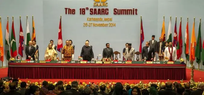
Indian PM Announces Satellite for SAARC Nations
In recent news by Shanghai Daily , during the inaugural session of the 18th South Asian Association for Regional Cooperation (SAARC) in Kathmandu, Nepal, Indian Prime Minister Narendra Modi said the
DoT : GIS Mapping of Telecom Towers
According to recent news by Economic Times, Department of Telecommunications (DoT), Government of India, has asked the telecom service operators in the country to put 584,000 telecom towers on Geographic Information

Mapping of Multi-Hazard Coastal Vulnerability
Earth System Science Organization (ESSO) – Indian National Centre for Ocean Information Services (INCOIS), Hyderabad and ESSO-Integrated Coastal and Marine Area Management (ICMAM), Chennai have carried out mapping and demarcating of
