NGA Releases Biggest Collection of Arctic Elevation Data Yet at Esri FedGIS Conference
ArcticDEM Provides High-Quality Elevation Data and Enables Communities to Take Action
Redlands, California—Esri, the global leader in spatial analytics, together with the ArcticDEM project—a public-private initiative to produce high-resolution, high-quality digital elevation models (DEM) of the Arctic—has released the largest addition of new elevation models to the project thus far.
The ArcticDEM project is an ongoing collaboration between National Geospatial-Intelligence Agency (NGA), the Polar Geospatial Center, and Esri to produce high-resolution elevation models to support scientific and national security implications in the Arctic. Coupled with the accessibility of Esri’s online platform, ArcticDEM can meet the need for high-quality elevation data in remote locations and provide accurate measurement of topographic changes.
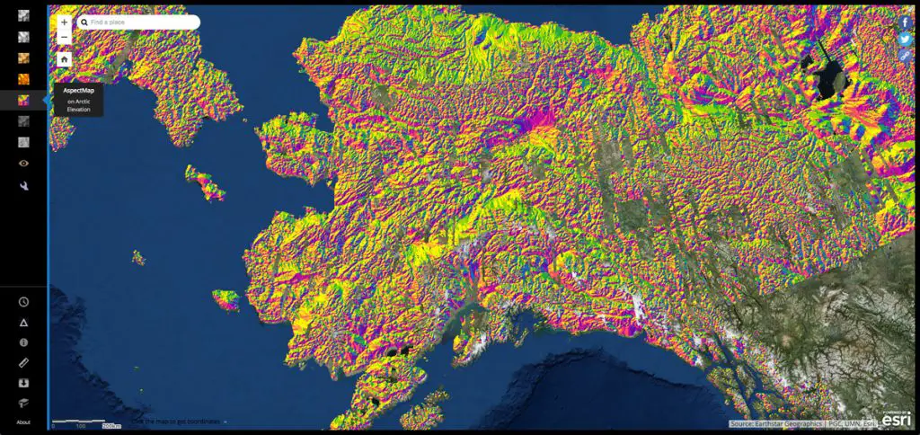
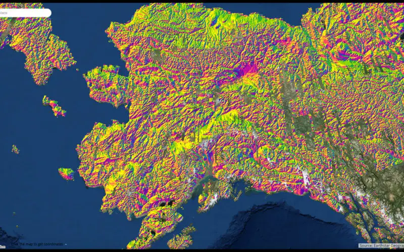
New models have been added to the ArcticDEM project maps.
“The latest release of this elevation data is the largest collection to date for this project,” said Don Kerr, Chief of News and Information, National Geospatial-Intelligence Agency. “The release includes a much broader area of the Arctic geography than ever before, comprising more populated areas that will see a substantive benefit from access to this kind of detailed location data.”
New elevation models on Esri’s public online portal show stunning surface detail from mainland Canada and Russia. In many locations, the models are created from images collected on multiple dates, allowing anyone to see how the landscape changes over time—for example, showing the rate at which glaciers are receding. Since the Arctic region is uniquely challenged by the effects of climate change, including melting ice, this elevation data provides a great resource for enabling better planning and adaptation. For instance, elevation models can help local communities monitor coastal erosion in order to identify important structures that are at high risk of storm damage.
“The growing collection of detailed data and imagery from this collaborative project is a useful tool for federal agencies that depend on location data,” said Peter Becker, ArcGIS product manager, Esri. “For instance, the ArcticDEM information is a valuable source of data for maritime navigational charts that must have accurate and up-to-date coastal points of reference.”
The National Geospatial-Intelligence Agency presented the new ArcticDEM elevation data at the twentieth annual Esri Federal GIS (FedGIS) Conference, held February 13 and14 at the Walter E. Washington Convention Center in Washington, DC.
Explore visualized data from the ArcticDEM project at the ArcticDEM Explorer website.
# # #
Press Information:
Karen Richardson, Esri
Tel.: 587-873-0157
E-mail (press only): press@esri.com
General Information: info@esri.com