German-French climate mission enters its implementation phase
- Small satellite mission to measure methane concentration in Earth’s atmosphere from 2021 onwards.
- Environmental impact of methane is 25 times higher than that of carbon dioxide.
- Germany’s contribution is the methane LIDAR, an innovative measuring instrument that can be operated at all latitudes regardless of sunlight.
On 17 February 2017, the German Aerospace Center (Deutsches Zentrum für Luft-und Raumfahrt; DLR) Space Administration and Airbus Defence and Space GmbH signed a contract for the design and construction phases of the German-French climate satellite MERLIN
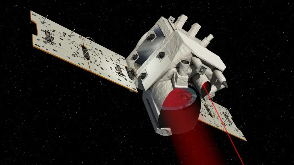
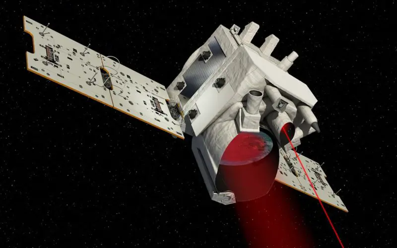
Artist’s Impression of MERLIN
The contract was signed at the Airbus site in Ottobrunn and includes the German contribution to the mission – namely, the development and construction of the methane LIDAR (Light Detection And Ranging), the measuring instrument on board the MERLIN satellite. The core part of the instrument is a laser, which can send out light pulses on two different wavelengths and thus measure the methane concentration at all latitudes with great precision regardless of sunlight.
“Space missions such as MERLIN measure trace gases in our atmosphere and therefore help us to understand the changes that are taking place in our climate; this is an important element towards implementing the United Nations Paris Agreement on Climate Change,” said Gerd Gruppe, DLR Executive Board Member responsible for the Space Administration, on the occasion of the contract signing. “Methane is a particularly strong greenhouse gas. Its effect on the climate is 25 times more powerful than that of carbon dioxide (CO2) on a timescale of 100 years. And although the concentration of methane is significantly lower than that of carbon dioxide, at present it contributes to approximately 20 percent of global warming. Effective measures for climate protection must therefore address methane. For that reason, it is necessary to have measurements from all over the world. This can only be achieved with satellites.”
Methane is warming up our planet
Methane affects Earth in three different ways: first of all, it has its own global warming potential. In addition, it facilitates the formation of ozone in the lower levels of the atmosphere and also reduces aerosols in the atmosphere. These sulphur aerosols reflect incoming sunlight directly back into space. More methane therefore means less reflection and thus also additional global warming.
Searching using light waves
The LIDAR instrument is being developed and constructed in Germany on behalf of the DLR Space Administration, funded by the Federal Ministry for Economic Affairs and Energy (BMWi). “MERLIN is a great technological challenge. Germany is breaking new technological ground with the innovative laser. We are thus fostering innovation far beyond the boundaries of the project,” stressed Gruppe.
The laser is not harmful to the human eye. The wavelengths used fall within the infrared range. These have been chosen so that one of them is absorbed by methane, whereas the other one is not. MERLIN emits two pulses in short succession to the same location on Earth’s surface. The reflected light is then picked up and registered by a telescope on the small satellite. One of the pulses is weakened by the methane that is present in the atmosphere – the other is not. This difference enables scientists to determine the quantity of methane present between the satellite and the ground. The data acquired by the satellite can also be transmitted to ground stations several times a day.
The LIDAR process has several advantages: the data contain minimal systematic errors. It is therefore possible, using computer models to evaluate the data, to reliably identify sources and sinks of methane and their global distribution. Methane is released in environments where organic matter decomposes where there is little or no oxygen – mainly in the agriculture, forestry, mining and gas extraction industries, as well as in sewage treatment plants and landfill sites. But the largest amount is released as a result of permafrost soil thawing in the Arctic. MERLIN has been designed to track down these sources of methane around the world and make use of any holes in the clouds with its short light pulses. In addition, as an ‘active instrument’ the LIDAR generates its light itself, the reflection of which it measures. This means that the climate satellite is also capable of monitoring certain regions on Earth – even at night.