Another ‘guardian’ of the European Earth observation programme Copernicus is in orbit
- Together with its ‘twin satellite’ Sentinel-2A, the new environmental monitoring system Sentinel-2B doubles the recording frequency.
- Every point on Earth is recorded every five days, and changes in the surface are documented continuously and in the long term.
- A high-resolution optical camera allows the satellites to provide important information on global agriculture, forestry and water management, as well as for spatial planning and disaster relief.
- The mission shows the specific contribution of space applications to finding solutions for global challenges.
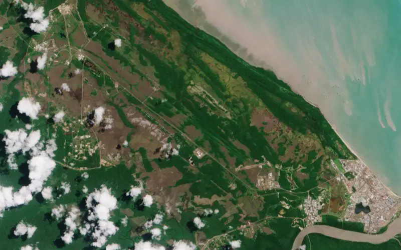
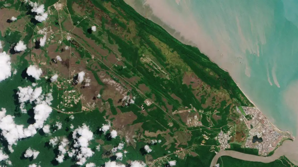
Just two years after its ‘twin satellite’ was launched on 7 March 2017 at 02:49 CET (6 March at 22:49 local time), the European Earth observation satellite Sentinel-2B set off on its mission on board a Vega rocket from Europe’s Spaceport in French Guiana. The approximately 1.1-ton satellite will monitor Earth from an altitude of 786 kilometres in a sun-synchronous orbit. Its most important task is to document changes to land surface and vegetation between 84 degrees North and 56 degrees South latitude. Will the harvest be enough for the population? How intensively should farmers fertilise? How healthy are our forests? Sentinel-2B will monitor all Earth’s land surfaces except Antarctica, including all the islands that belong to the EU and all other islands larger than 100 square kilometres, as well as coastal areas, lakes, the Mediterranean Sea, and other landlocked bodies of water.
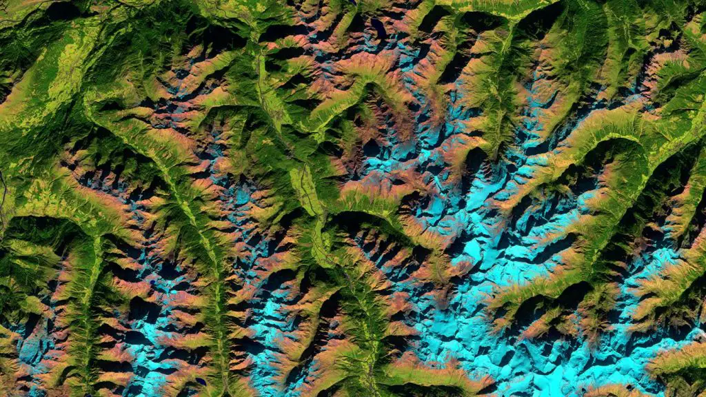
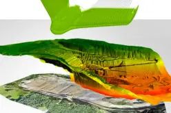
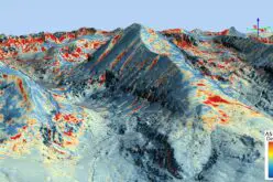
The Ötztal Alps,taken with Sentinel-2A
“With its high-resolution optical camera, Sentinel-2B can provide important information for global agriculture, forestry and water management, as well as for spatial planning and disaster relief. This demonstrates once again the important contribution that space technology can make to finding solutions to global challenges,” explains Gerd Gruppe, German Aerospace Center (Deutsches Zentrum für Luft- und Raumfahrt; DLR) Executive Board Member responsible for the Space Administration. “The combination of 13 high-resolution spectral bands, a swath width of 290 kilometres, and regular global coverage recurring every five days makes the twin satellites Sentinel-2A and Sentinel-2B interesting for new applications. The programme is setting new standards for modern environmental missions in the optical and near infrared.”
Europe’s Spaceport in French Guiana
The Sentinel satellites are part of the European Commission’s Copernicus programme (see info box). Its purpose is to collect and evaluate remote sensing data of Earth. The data has been provided free of charge to authorities, companies, science and every interested citizen since the start of the programme in 2014. ESA invested 339 million euro in the development of both Sentinel-2 satellites on behalf of the European Commission. Germany is involved in these developments with just over 32 percent – the DLR Space Administration is responsible for the corresponding ESA programmes on behalf of the German Federal Ministry of Transport and Digital Infrastructure (BMVI). In all, four optical Sentinel-2 satellites will be part of the Copernicus satellite family, which will comprise a total of 20 satellites. Sentinel-2A has been in orbit since 23 June 2015, Sentinel-2C and Sentinel-2D should follow from 2022 onwards.
Together with Sentinel-2A, Sentinel-2B doubles the recording frequency – every point on Earth will now be recorded every five days – and halves the failure probability, which are both central requirements for users of Copernicus data.
The ‘eye’ of the Sentinel-2 satellites – the so-called multispectral imager (MSI) – can generate high-resolution optical images in the visible, near and short-wave infrared range. The MSI provides images in a 290-kilometre swath – significantly more than any other Earth observation satellite. “Not only do the Sentinel-2 satellites record colours in the visible range of the spectrum, but also in the near infrared range, which also provides us with information on the health of plants and their growth state. This enables a more targeted use of fertilisers in agriculture, as well as better harvest forecasts and, ultimately, global food security, for instance. Sentinel-2 will also provide information about the condition of forests and landlocked bodies of water – important fundamental data required to counter global pressure on natural resources,” said Jörn Hoffmann, Director of the Copernicus Programme at the DLR Space Administration. The concept for each Sentinel mission is to have two operative satellites in orbit at the same time. With Sentinel-2B, the second satellite has been launched. This satellite will ensure data continuity and should provide long-term Earth-monitoring data into the 2030s.
Copernicus
How healthy will our air be five years from now? How clean will our water be? And how much will the rainforest have shrunk? In order to answer these and similar questions, the European Commission launched the Earth observation programme Copernicus.
Copernicus comprises six satellite families, the so-called Sentinels that study the Earth and its atmosphere, thus providing important data for climate protection, sustainable development, humanitarian aid, food security and the health of the oceans. This satellite data is complemented by measuring devices on the ground, in the air and in water. The European Space Agency (ESA) and the European Organisation for the Exploitation of Meteorological Satellites (EUMETSAT) are responsible for operating all 20 environmental satellites. In Germany, the Federal Ministry of Transport and Digital Infrastructure (BMVI) is the lead organisation responsible for Copernicus. DLR supports the programme in Germany.
German partners from industry and research
As for Sentinel-2A, the main contractor for the construction of Sentinel-2B is Airbus Defence & Space in Friedrichshafen, where the satellite platform was also assembled. Further assembly and testing took place at IABG AG in Munich. Important components for the instruments and platform were manufactured by various companies in Germany – for instance Jena-Optronik GmbH and ZARM Technik AG. The technology for the optical data transmission in space, the so-called laser communication terminals (LCTs), were developed and manufactured by Tesat Spacecom in Backnang. The German Earth Observation Center (EOC) at the DLR site in Oberpfaffenhofen is also involved in the Sentinel missions, and thus the Copernicus programme.